You are here: Home > Network List > PF - Volcanologic Network of Piton de Fournaise-OVPF Stations List
> Station HIM cratere Himiltrude > Earthquake Result Viewer
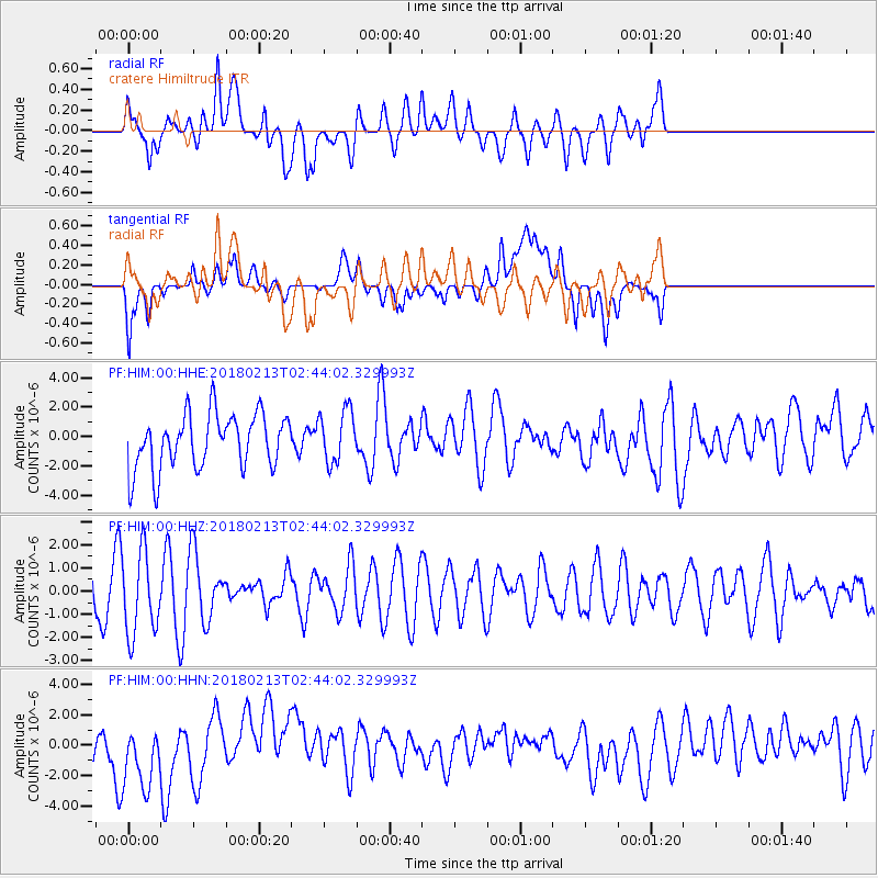
HIM cratere Himiltrude - Earthquake Result Viewer
*The percent match for this event was below the threshold and hence no stack was calculated.
| Earthquake location: |
South Of Mariana Islands |
| Earthquake latitude/longitude: |
13.7/146.4 |
| Earthquake time(UTC): |
2018/02/13 (044) 02:31:09 GMT |
| Earthquake Depth: |
10 km |
| Earthquake Magnitude: |
5.6 mb |
| Earthquake Catalog/Contributor: |
NEIC PDE/us |
|
| Network: |
PF Volcanologic Network of Piton de Fournaise-OVPF |
| Station: |
HIM cratere Himiltrude |
| Lat/Lon: |
21.21 S/55.72 E |
| Elevation: |
1958 m |
|
| Distance: |
95.5 deg |
| Az: |
249.602 deg |
| Baz: |
77.462 deg |
| Ray Param: |
$rayparam |
*The percent match for this event was below the threshold and hence was not used in the summary stack. |
|
| Radial Match: |
37.79133 % |
| Radial Bump: |
400 |
| Transverse Match: |
45.548103 % |
| Transverse Bump: |
400 |
| SOD ConfigId: |
2546091 |
| Insert Time: |
2018-02-27 02:32:50.143 +0000 |
| GWidth: |
2.5 |
| Max Bumps: |
400 |
| Tol: |
0.001 |
|
Signal To Noise
| Channel | StoN | STA | LTA |
| PF:HIM:00:HHZ:20180213T02:44:02.329993Z | 1.3753172 | 1.7759542E-6 | 1.2913051E-6 |
| PF:HIM:00:HHN:20180213T02:44:02.329993Z | 1.5852274 | 2.4703183E-6 | 1.558337E-6 |
| PF:HIM:00:HHE:20180213T02:44:02.329993Z | 0.9650321 | 1.816533E-6 | 1.8823549E-6 |
| Arrivals |
| Ps | |
| PpPs | |
| PsPs/PpSs | |


