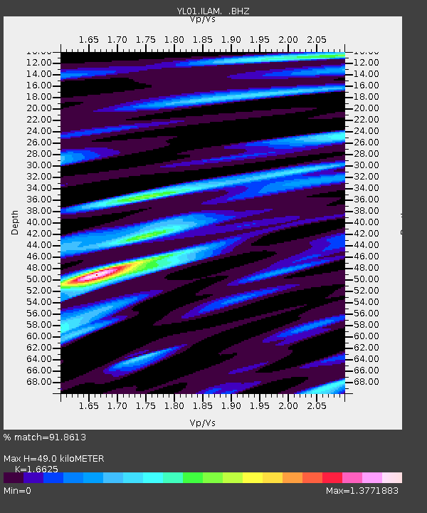
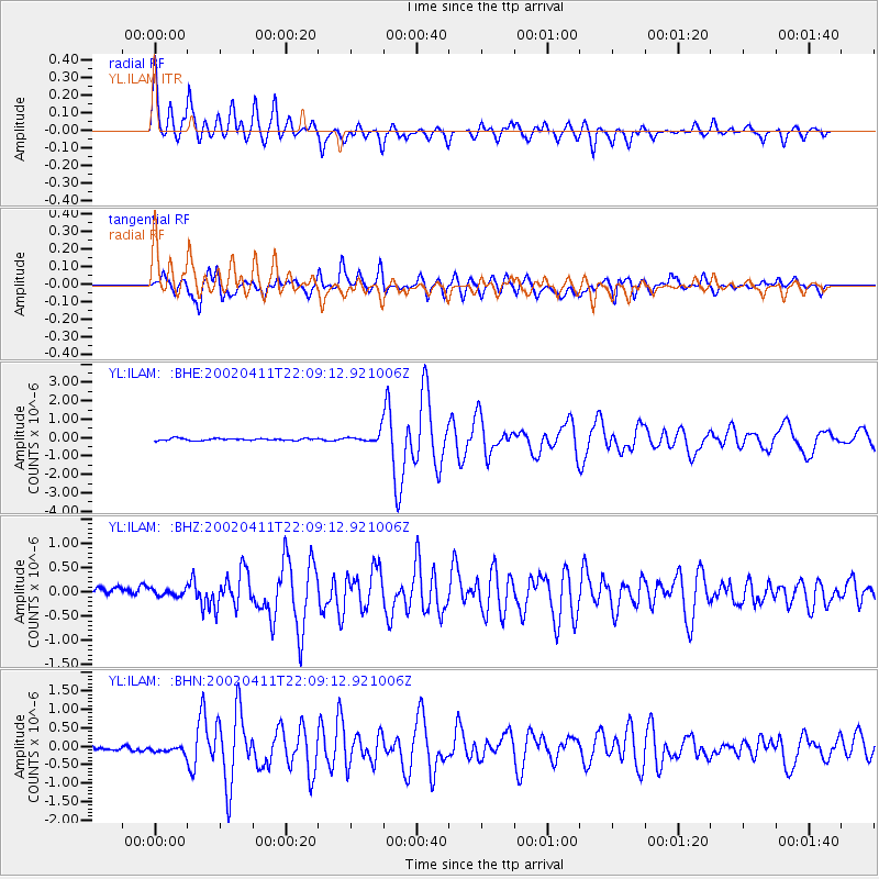
ILAM YL.ILAM - Earthquake Result Viewer

Earthquake location: Vanuatu Islands
Earthquake latitude/longitude: -14.4/167.7
Earthquake time(UTC): 2002/04/11 (101) 21:56:56 GMT
Earthquake Depth: 10 km
Earthquake Magnitude: 5.9 MB, 6.2 MS, 6.2 MW, 6.1 MW
Earthquake Catalog/Contributor: WHDF/NEIC
Network: YL Himalayan Nepal Tibet Experiment
Station: ILAM YL.ILAM
Lat/Lon: 26.91 N/87.92 E
Elevation: 1181 m
Distance: 87.6 deg
Az: 298.415 deg
Baz: 107.358 deg
Ray Param: 0.04323898
Estimated Moho Depth: 49.0 km
Estimated Crust Vp/Vs: 1.66
Assumed Crust Vp: 6.236 km/s
Estimated Crust Vs: 3.751 km/s
Estimated Crust Poisson's Ratio: 0.22
Radial Match: 91.8613 %
Radial Bump: 400
Transverse Match: 84.14394 %
Transverse Bump: 400
SOD ConfigId: 16820
Insert Time: 2010-02-26 15:55:54.724 +0000
GWidth: 2.5
Max Bumps: 400
Tol: 0.001

Signal To Noise

ChannelStoNSTALTA
YL:ILAM: :BHZ:20020411T22:09:12.921006Z1.05723337.720265E-87.302329E-8
YL:ILAM: :BHN:20020411T22:09:12.921006Z1.75297421.1002186E-76.2762965E-8
YL:ILAM: :BHE:20020411T22:09:12.921006Z5.08952952.9511088E-75.798392E-8
Arrivals
Ps5.3 SECOND
PpPs20 SECOND
PsPs/PpSs26 SECOND