You are here: Home > Network List > IU - Global Seismograph Network (GSN - IRIS/USGS) Stations List
> Station JOHN Johnston Island, USA > Earthquake Result Viewer
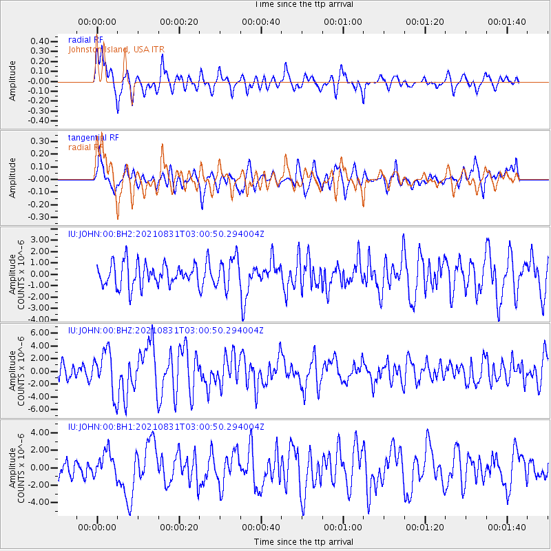
JOHN Johnston Island, USA - Earthquake Result Viewer
*The percent match for this event was below the threshold and hence no stack was calculated.
| Earthquake location: |
Kermadec Islands, New Zealand |
| Earthquake latitude/longitude: |
-30.0/-177.5 |
| Earthquake time(UTC): |
2021/08/31 (243) 02:52:49 GMT |
| Earthquake Depth: |
10 km |
| Earthquake Magnitude: |
6.3 mww |
| Earthquake Catalog/Contributor: |
NEIC PDE/us |
|
| Network: |
IU Global Seismograph Network (GSN - IRIS/USGS) |
| Station: |
JOHN Johnston Island, USA |
| Lat/Lon: |
16.73 N/169.53 W |
| Elevation: |
2.0 m |
|
| Distance: |
47.1 deg |
| Az: |
10.478 deg |
| Baz: |
189.48 deg |
| Ray Param: |
$rayparam |
*The percent match for this event was below the threshold and hence was not used in the summary stack. |
|
| Radial Match: |
75.537476 % |
| Radial Bump: |
400 |
| Transverse Match: |
67.843666 % |
| Transverse Bump: |
400 |
| SOD ConfigId: |
25131211 |
| Insert Time: |
2021-09-14 03:22:59.845 +0000 |
| GWidth: |
2.5 |
| Max Bumps: |
400 |
| Tol: |
0.001 |
|
Signal To Noise
| Channel | StoN | STA | LTA |
| IU:JOHN:00:BHZ:20210831T03:00:50.294004Z | 2.9893613 | 3.450013E-6 | 1.154097E-6 |
| IU:JOHN:00:BH1:20210831T03:00:50.294004Z | 1.4036609 | 1.5194277E-6 | 1.0824749E-6 |
| IU:JOHN:00:BH2:20210831T03:00:50.294004Z | 1.3755739 | 1.3344444E-6 | 9.701001E-7 |
| Arrivals |
| Ps | |
| PpPs | |
| PsPs/PpSs | |


