You are here: Home > Network List > IW - Intermountain West Stations List
> Station MOOW Moose Ponds, Wyoming, USA > Earthquake Result Viewer
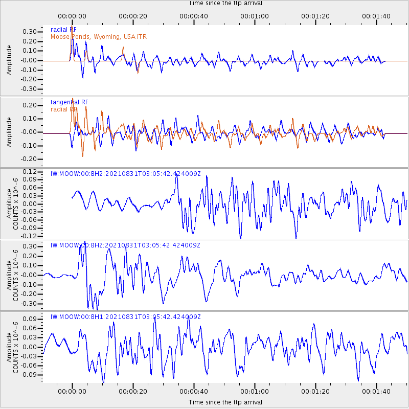
MOOW Moose Ponds, Wyoming, USA - Earthquake Result Viewer
*The percent match for this event was below the threshold and hence no stack was calculated.
| Earthquake location: |
Kermadec Islands, New Zealand |
| Earthquake latitude/longitude: |
-30.0/-177.5 |
| Earthquake time(UTC): |
2021/08/31 (243) 02:52:49 GMT |
| Earthquake Depth: |
10 km |
| Earthquake Magnitude: |
6.3 mww |
| Earthquake Catalog/Contributor: |
NEIC PDE/us |
|
| Network: |
IW Intermountain West |
| Station: |
MOOW Moose Ponds, Wyoming, USA |
| Lat/Lon: |
43.75 N/110.74 W |
| Elevation: |
2128 m |
|
| Distance: |
95.4 deg |
| Az: |
41.984 deg |
| Baz: |
233.23 deg |
| Ray Param: |
$rayparam |
*The percent match for this event was below the threshold and hence was not used in the summary stack. |
|
| Radial Match: |
77.06698 % |
| Radial Bump: |
400 |
| Transverse Match: |
64.66483 % |
| Transverse Bump: |
400 |
| SOD ConfigId: |
25131211 |
| Insert Time: |
2021-09-14 03:23:20.648 +0000 |
| GWidth: |
2.5 |
| Max Bumps: |
400 |
| Tol: |
0.001 |
|
Signal To Noise
| Channel | StoN | STA | LTA |
| IW:MOOW:00:BHZ:20210831T03:05:42.424009Z | 9.953834 | 1.6772174E-7 | 1.6849965E-8 |
| IW:MOOW:00:BH1:20210831T03:05:42.424009Z | 0.8600976 | 3.1426985E-8 | 3.653886E-8 |
| IW:MOOW:00:BH2:20210831T03:05:42.424009Z | 1.9573807 | 4.110038E-8 | 2.0997645E-8 |
| Arrivals |
| Ps | |
| PpPs | |
| PsPs/PpSs | |


