ILAM YL.ILAM - Earthquake Result Viewer
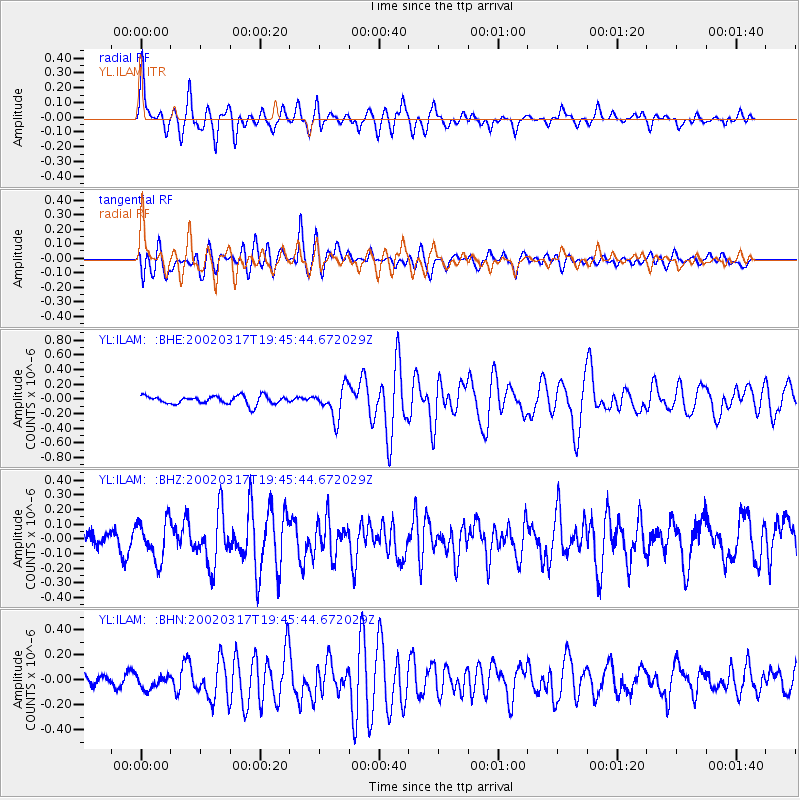
Earthquake location: Prince Edward Islands Region
Earthquake latitude/longitude: -45.2/35.1
Earthquake time(UTC): 2002/03/17 (076) 19:33:33 GMT
Earthquake Depth: 10 km
Earthquake Magnitude: 5.5 MB, 5.7 MS, 6.0 MW, 6.0 MW
Earthquake Catalog/Contributor: WHDF/NEIC
Network: YL Himalayan Nepal Tibet Experiment
Station: ILAM YL.ILAM
Lat/Lon: 26.91 N/87.92 E
Elevation: 1181 m
Distance: 86.4 deg
Az: 45.466 deg
Baz: 214.347 deg
Ray Param: 0.044084113
Estimated Moho Depth: 19.75 km
Estimated Crust Vp/Vs: 1.69
Assumed Crust Vp: 6.236 km/s
Estimated Crust Vs: 3.684 km/s
Estimated Crust Poisson's Ratio: 0.23
Radial Match: 86.68928 %
Radial Bump: 400
Transverse Match: 79.2002 %
Transverse Bump: 400
SOD ConfigId: 16820
Insert Time: 2010-02-26 15:56:03.354 +0000
GWidth: 2.5
Max Bumps: 400
Tol: 0.001

Signal To Noise

ChannelStoNSTALTA
YL:ILAM: :BHZ:20020317T19:45:44.672029Z2.41484141.3411308E-75.553701E-8
YL:ILAM: :BHN:20020317T19:45:44.672029Z1.29564955.594071E-84.3175806E-8
YL:ILAM: :BHE:20020317T19:45:44.672029Z3.61149952.0682258E-75.7267787E-8
Arrivals
Ps2.2 SECOND
PpPs8.3 SECOND
PsPs/PpSs11 SECOND