You are here: Home > Network List > US - United States National Seismic Network Stations List
> Station DUG Dugway, Tooele County, Utah, USA > Earthquake Result Viewer
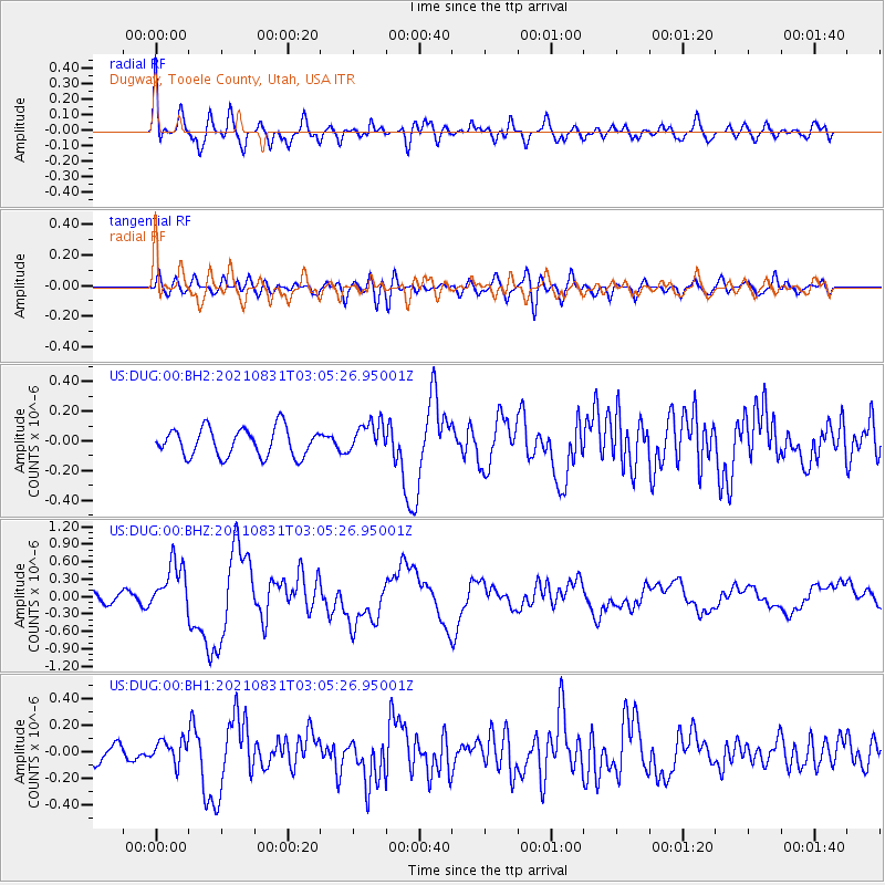
DUG Dugway, Tooele County, Utah, USA - Earthquake Result Viewer
*The percent match for this event was below the threshold and hence no stack was calculated.
| Earthquake location: |
Kermadec Islands, New Zealand |
| Earthquake latitude/longitude: |
-30.0/-177.5 |
| Earthquake time(UTC): |
2021/08/31 (243) 02:52:49 GMT |
| Earthquake Depth: |
10 km |
| Earthquake Magnitude: |
6.3 mww |
| Earthquake Catalog/Contributor: |
NEIC PDE/us |
|
| Network: |
US United States National Seismic Network |
| Station: |
DUG Dugway, Tooele County, Utah, USA |
| Lat/Lon: |
40.19 N/112.81 W |
| Elevation: |
1477 m |
|
| Distance: |
92.0 deg |
| Az: |
43.865 deg |
| Baz: |
231.729 deg |
| Ray Param: |
$rayparam |
*The percent match for this event was below the threshold and hence was not used in the summary stack. |
|
| Radial Match: |
76.88497 % |
| Radial Bump: |
400 |
| Transverse Match: |
62.600433 % |
| Transverse Bump: |
400 |
| SOD ConfigId: |
25131211 |
| Insert Time: |
2021-09-14 03:29:19.870 +0000 |
| GWidth: |
2.5 |
| Max Bumps: |
400 |
| Tol: |
0.001 |
|
Signal To Noise
| Channel | StoN | STA | LTA |
| US:DUG:00:BHZ:20210831T03:05:26.95001Z | 4.537155 | 4.1555379E-7 | 9.158906E-8 |
| US:DUG:00:BH1:20210831T03:05:26.95001Z | 0.9654831 | 8.380006E-8 | 8.6795986E-8 |
| US:DUG:00:BH2:20210831T03:05:26.95001Z | 1.1141993 | 1.0518874E-7 | 9.4407476E-8 |
| Arrivals |
| Ps | |
| PpPs | |
| PsPs/PpSs | |


