You are here: Home > Network List > GS - US Geological Survey Networks Stations List
> Station DEC06 Boomer > Earthquake Result Viewer
DEC06 Boomer - Earthquake Result Viewer
*The percent match for this event was below the threshold and hence no stack was calculated.
| Earthquake location: |
North Of Ascension Island |
| Earthquake latitude/longitude: |
-0.1/-17.8 |
| Earthquake time(UTC): |
2018/02/15 (046) 08:27:22 GMT |
| Earthquake Depth: |
10 km |
| Earthquake Magnitude: |
5.6 Mww |
| Earthquake Catalog/Contributor: |
NEIC PDE/us |
|
| Network: |
GS US Geological Survey Networks |
| Station: |
DEC06 Boomer |
| Lat/Lon: |
39.90 N/88.95 W |
| Elevation: |
215 m |
|
| Distance: |
75.6 deg |
| Az: |
311.287 deg |
| Baz: |
102.384 deg |
| Ray Param: |
$rayparam |
*The percent match for this event was below the threshold and hence was not used in the summary stack. |
|
| Radial Match: |
57.08882 % |
| Radial Bump: |
400 |
| Transverse Match: |
62.115685 % |
| Transverse Bump: |
400 |
| SOD ConfigId: |
2546091 |
| Insert Time: |
2018-03-01 08:28:31.261 +0000 |
| GWidth: |
2.5 |
| Max Bumps: |
400 |
| Tol: |
0.001 |
|
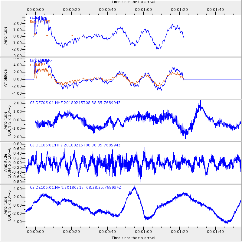
Signal To Noise
| Channel | StoN | STA | LTA |
| GS:DEC06:01:HHZ:20180215T08:38:35.768994Z | 1.1763706 | 2.0494701E-7 | 1.7421976E-7 |
| GS:DEC06:01:HHN:20180215T08:38:35.768994Z | 1.6012405 | 2.4004244E-6 | 1.499103E-6 |
| GS:DEC06:01:HHE:20180215T08:38:35.768994Z | 1.77366 | 9.635719E-7 | 5.4326756E-7 |
| Arrivals |
| Ps | |
| PpPs | |
| PsPs/PpSs | |


