ILAM YL.ILAM - Earthquake Result Viewer
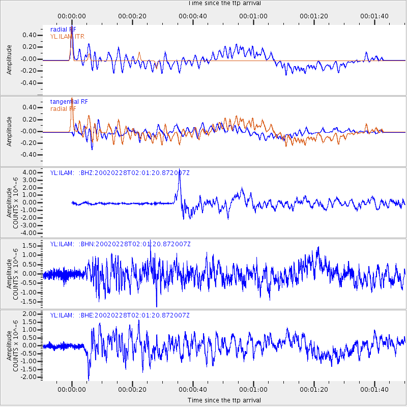
Earthquake location: New Britain Region, P.N.G.
Earthquake latitude/longitude: -5.7/151.3
Earthquake time(UTC): 2002/02/28 (059) 01:50:48 GMT
Earthquake Depth: 40 km
Earthquake Magnitude: 6.0 MB, 6.3 MS, 6.3 MW, 6.2 MW
Earthquake Catalog/Contributor: WHDF/NEIC
Network: YL Himalayan Nepal Tibet Experiment
Station: ILAM YL.ILAM
Lat/Lon: 26.91 N/87.92 E
Elevation: 1181 m
Distance: 69.2 deg
Az: 301.418 deg
Baz: 107.998 deg
Ray Param: 0.055708516
Estimated Moho Depth: 32.75 km
Estimated Crust Vp/Vs: 2.04
Assumed Crust Vp: 6.236 km/s
Estimated Crust Vs: 3.053 km/s
Estimated Crust Poisson's Ratio: 0.34
Radial Match: 81.65793 %
Radial Bump: 400
Transverse Match: 88.116066 %
Transverse Bump: 400
SOD ConfigId: 16820
Insert Time: 2010-02-26 15:56:10.059 +0000
GWidth: 2.5
Max Bumps: 400
Tol: 0.001

Signal To Noise

ChannelStoNSTALTA
YL:ILAM: :BHN:20020228T02:01:20.872007Z1.17010381.5290108E-71.306731E-7
YL:ILAM: :BHE:20020228T02:01:20.872007Z1.57900641.5489448E-79.8096166E-8
YL:ILAM: :BHZ:20020228T02:01:20.872007Z4.9346263.7208247E-77.540236E-8
Arrivals
Ps5.6 SECOND
PpPs15 SECOND
PsPs/PpSs21 SECOND