You are here: Home > Network List > US - United States National Seismic Network Stations List
> Station HAWA Hanford, Washington, USA > Earthquake Result Viewer
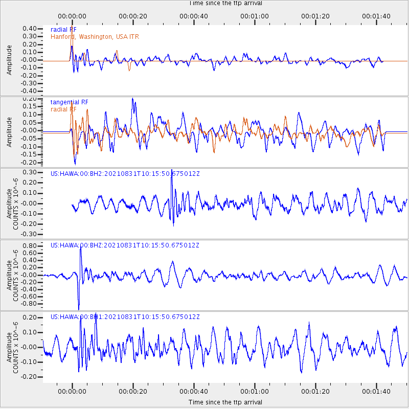
HAWA Hanford, Washington, USA - Earthquake Result Viewer
*The percent match for this event was below the threshold and hence no stack was calculated.
| Earthquake location: |
Fiji Islands Region |
| Earthquake latitude/longitude: |
-18.1/-178.2 |
| Earthquake time(UTC): |
2021/08/31 (243) 10:04:54 GMT |
| Earthquake Depth: |
559 km |
| Earthquake Magnitude: |
5.5 Mww |
| Earthquake Catalog/Contributor: |
NEIC PDE/us |
|
| Network: |
US United States National Seismic Network |
| Station: |
HAWA Hanford, Washington, USA |
| Lat/Lon: |
46.39 N/119.53 W |
| Elevation: |
364 m |
|
| Distance: |
83.2 deg |
| Az: |
36.551 deg |
| Baz: |
234.914 deg |
| Ray Param: |
$rayparam |
*The percent match for this event was below the threshold and hence was not used in the summary stack. |
|
| Radial Match: |
52.237774 % |
| Radial Bump: |
400 |
| Transverse Match: |
59.79926 % |
| Transverse Bump: |
400 |
| SOD ConfigId: |
25131211 |
| Insert Time: |
2021-09-14 10:25:58.842 +0000 |
| GWidth: |
2.5 |
| Max Bumps: |
400 |
| Tol: |
0.001 |
|
Signal To Noise
| Channel | StoN | STA | LTA |
| US:HAWA:00:BHZ:20210831T10:15:50.675012Z | 3.9419656 | 3.343561E-7 | 8.481963E-8 |
| US:HAWA:00:BH1:20210831T10:15:50.675012Z | 1.4595699 | 8.790497E-8 | 6.0226625E-8 |
| US:HAWA:00:BH2:20210831T10:15:50.675012Z | 2.7142396 | 1.1795729E-7 | 4.3458687E-8 |
| Arrivals |
| Ps | |
| PpPs | |
| PsPs/PpSs | |


