
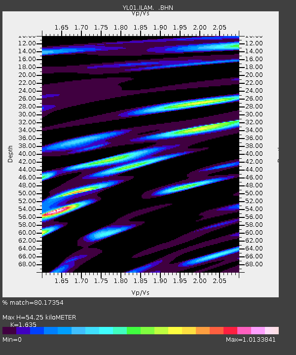
ILAM YL.ILAM - Earthquake Result Viewer
| ||||||||||||||||||
| ||||||||||||||||||
| ||||||||||||||||||
|
Signal To Noise
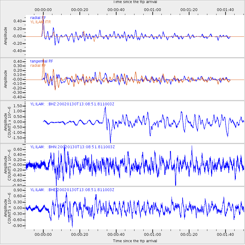
| Channel | StoN | STA | LTA |
| YL:ILAM: :BHN:20020130T13:08:51.811003Z | 1.8839405 | 1.6198435E-7 | 8.598167E-8 |
| YL:ILAM: :BHE:20020130T13:08:51.811003Z | 3.4257793 | 2.2748762E-7 | 6.640464E-8 |
| YL:ILAM: :BHZ:20020130T13:08:51.811003Z | 5.103498 | 5.1985785E-7 | 1.01863044E-7 |
| Arrivals | |
| Ps | 5.7 SECOND |
| PpPs | 22 SECOND |
| PsPs/PpSs | 28 SECOND |

