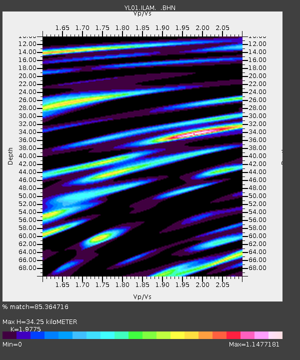
ILAM YL.ILAM - Earthquake Result Viewer
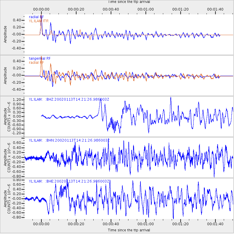
Earthquake location: New Britain Region, P.N.G.
Earthquake latitude/longitude: -5.7/151.1
Earthquake time(UTC): 2002/01/13 (013) 14:10:56 GMT
Earthquake Depth: 44 km
Earthquake Magnitude: 5.9 MB, 6.4 MS, 6.3 MW, 6.3 MW
Earthquake Catalog/Contributor: WHDF/NEIC
Network: YL Himalayan Nepal Tibet Experiment
Station: ILAM YL.ILAM
Lat/Lon: 26.91 N/87.92 E
Elevation: 1181 m
Distance: 69.1 deg
Az: 301.461 deg
Baz: 108.069 deg
Ray Param: 0.055813175
Estimated Moho Depth: 34.25 km
Estimated Crust Vp/Vs: 1.98
Assumed Crust Vp: 6.236 km/s
Estimated Crust Vs: 3.153 km/s
Estimated Crust Poisson's Ratio: 0.33
Radial Match: 85.364716 %
Radial Bump: 400
Transverse Match: 82.81924 %
Transverse Bump: 400
SOD ConfigId: 16820
Insert Time: 2010-02-26 15:56:14.632 +0000
GWidth: 2.5
Max Bumps: 400
Tol: 0.001

Signal To Noise

ChannelStoNSTALTA
YL:ILAM: :BHN:20020113T14:21:26.986003Z2.10802751.2558165E-75.9573058E-8
YL:ILAM: :BHE:20020113T14:21:26.986003Z4.30083232.580958E-76.001067E-8
YL:ILAM: :BHZ:20020113T14:21:26.986003Z9.5269015.4376E-75.7076274E-8
Arrivals
Ps5.5 SECOND
PpPs16 SECOND
PsPs/PpSs21 SECOND