ILAM YL.ILAM - Earthquake Result Viewer
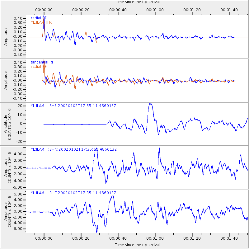
Earthquake location: Vanuatu Islands
Earthquake latitude/longitude: -17.6/167.9
Earthquake time(UTC): 2002/01/02 (002) 17:22:48 GMT
Earthquake Depth: 21 km
Earthquake Magnitude: 6.3 MB, 7.5 MS, 7.3 MW, 7.1 MW
Earthquake Catalog/Contributor: WHDF/NEIC
Network: YL Himalayan Nepal Tibet Experiment
Station: ILAM YL.ILAM
Lat/Lon: 26.91 N/87.92 E
Elevation: 1181 m
Distance: 89.2 deg
Az: 298.445 deg
Baz: 110.086 deg
Ray Param: 0.04198894
Estimated Moho Depth: 10.5 km
Estimated Crust Vp/Vs: 2.10
Assumed Crust Vp: 6.236 km/s
Estimated Crust Vs: 2.973 km/s
Estimated Crust Poisson's Ratio: 0.35
Radial Match: 95.47023 %
Radial Bump: 400
Transverse Match: 90.11701 %
Transverse Bump: 400
SOD ConfigId: 16820
Insert Time: 2010-02-26 15:56:17.352 +0000
GWidth: 2.5
Max Bumps: 400
Tol: 0.001

Signal To Noise

ChannelStoNSTALTA
YL:ILAM: :BHN:20020102T17:35:11.486013Z1.79799835.605632E-83.117707E-8
YL:ILAM: :BHE:20020102T17:35:11.486013Z3.13673971.4478461E-74.615767E-8
YL:ILAM: :BHZ:20020102T17:35:11.486013Z5.30722574.993021E-79.4079674E-8
Arrivals
Ps1.9 SECOND
PpPs5.1 SECOND
PsPs/PpSs7.0 SECOND