You are here: Home > Network List > IW - Intermountain West Stations List
> Station MOOW Moose Ponds, Wyoming, USA > Earthquake Result Viewer
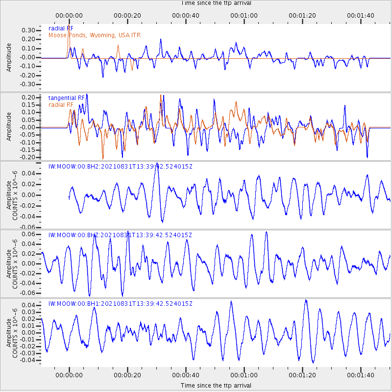
MOOW Moose Ponds, Wyoming, USA - Earthquake Result Viewer
*The percent match for this event was below the threshold and hence no stack was calculated.
| Earthquake location: |
Vanuatu Islands |
| Earthquake latitude/longitude: |
-13.7/167.5 |
| Earthquake time(UTC): |
2021/08/31 (243) 13:26:58 GMT |
| Earthquake Depth: |
10 km |
| Earthquake Magnitude: |
5.3 Mww |
| Earthquake Catalog/Contributor: |
NEIC PDE/us |
|
| Network: |
IW Intermountain West |
| Station: |
MOOW Moose Ponds, Wyoming, USA |
| Lat/Lon: |
43.75 N/110.74 W |
| Elevation: |
2128 m |
|
| Distance: |
93.5 deg |
| Az: |
45.936 deg |
| Baz: |
254.488 deg |
| Ray Param: |
$rayparam |
*The percent match for this event was below the threshold and hence was not used in the summary stack. |
|
| Radial Match: |
51.24202 % |
| Radial Bump: |
400 |
| Transverse Match: |
64.50269 % |
| Transverse Bump: |
400 |
| SOD ConfigId: |
25131211 |
| Insert Time: |
2021-09-14 13:37:20.359 +0000 |
| GWidth: |
2.5 |
| Max Bumps: |
400 |
| Tol: |
0.001 |
|
Signal To Noise
| Channel | StoN | STA | LTA |
| IW:MOOW:00:BHZ:20210831T13:39:42.524015Z | 2.5112731 | 3.2912798E-8 | 1.3106021E-8 |
| IW:MOOW:00:BH1:20210831T13:39:42.524015Z | 1.077479 | 1.7063522E-8 | 1.5836523E-8 |
| IW:MOOW:00:BH2:20210831T13:39:42.524015Z | 2.6476736 | 3.5303252E-8 | 1.3333688E-8 |
| Arrivals |
| Ps | |
| PpPs | |
| PsPs/PpSs | |


