You are here: Home > Network List > AK - Alaska Regional Network Stations List
> Station MDM Murphy Dome > Earthquake Result Viewer
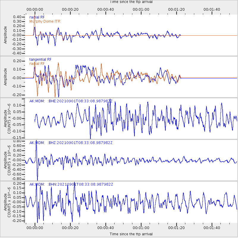
MDM Murphy Dome - Earthquake Result Viewer
*The percent match for this event was below the threshold and hence no stack was calculated.
| Earthquake location: |
Tonga Islands |
| Earthquake latitude/longitude: |
-18.7/-174.1 |
| Earthquake time(UTC): |
2021/09/01 (244) 08:21:09 GMT |
| Earthquake Depth: |
75 km |
| Earthquake Magnitude: |
5.2 Mww |
| Earthquake Catalog/Contributor: |
NEIC PDE/us |
|
| Network: |
AK Alaska Regional Network |
| Station: |
MDM Murphy Dome |
| Lat/Lon: |
64.96 N/148.23 W |
| Elevation: |
634 m |
|
| Distance: |
85.7 deg |
| Az: |
10.729 deg |
| Baz: |
204.49 deg |
| Ray Param: |
$rayparam |
*The percent match for this event was below the threshold and hence was not used in the summary stack. |
|
| Radial Match: |
56.52923 % |
| Radial Bump: |
400 |
| Transverse Match: |
56.22561 % |
| Transverse Bump: |
400 |
| SOD ConfigId: |
25131211 |
| Insert Time: |
2021-09-15 08:24:22.142 +0000 |
| GWidth: |
2.5 |
| Max Bumps: |
400 |
| Tol: |
0.001 |
|
Signal To Noise
| Channel | StoN | STA | LTA |
| AK:MDM: :BHZ:20210901T08:33:08.987982Z | 8.656992 | 3.235167E-7 | 3.737057E-8 |
| AK:MDM: :BHN:20210901T08:33:08.987982Z | 2.9643672 | 1.1147262E-7 | 3.760419E-8 |
| AK:MDM: :BHE:20210901T08:33:08.987982Z | 1.5224928 | 6.1669255E-8 | 4.0505448E-8 |
| Arrivals |
| Ps | |
| PpPs | |
| PsPs/PpSs | |


