You are here: Home > Network List > CN - Canadian National Seismograph Network Stations List
> Station INK INUVIK, NT > Earthquake Result Viewer
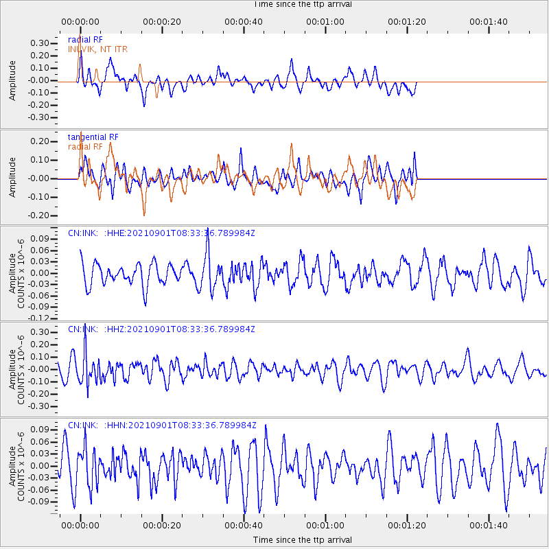
INK INUVIK, NT - Earthquake Result Viewer
*The percent match for this event was below the threshold and hence no stack was calculated.
| Earthquake location: |
Tonga Islands |
| Earthquake latitude/longitude: |
-18.7/-174.1 |
| Earthquake time(UTC): |
2021/09/01 (244) 08:21:09 GMT |
| Earthquake Depth: |
75 km |
| Earthquake Magnitude: |
5.2 Mww |
| Earthquake Catalog/Contributor: |
NEIC PDE/us |
|
| Network: |
CN Canadian National Seismograph Network |
| Station: |
INK INUVIK, NT |
| Lat/Lon: |
68.31 N/133.53 W |
| Elevation: |
44 m |
|
| Distance: |
91.6 deg |
| Az: |
13.998 deg |
| Baz: |
218.065 deg |
| Ray Param: |
$rayparam |
*The percent match for this event was below the threshold and hence was not used in the summary stack. |
|
| Radial Match: |
53.481403 % |
| Radial Bump: |
400 |
| Transverse Match: |
54.69331 % |
| Transverse Bump: |
400 |
| SOD ConfigId: |
25131211 |
| Insert Time: |
2021-09-15 08:32:25.259 +0000 |
| GWidth: |
2.5 |
| Max Bumps: |
400 |
| Tol: |
0.001 |
|
Signal To Noise
| Channel | StoN | STA | LTA |
| CN:INK: :HHZ:20210901T08:33:36.789984Z | 2.2857802 | 1.2283748E-7 | 5.373985E-8 |
| CN:INK: :HHN:20210901T08:33:36.789984Z | 1.1532303 | 4.8256293E-8 | 4.184446E-8 |
| CN:INK: :HHE:20210901T08:33:36.789984Z | 1.7705312 | 4.849378E-8 | 2.7389397E-8 |
| Arrivals |
| Ps | |
| PpPs | |
| PsPs/PpSs | |


