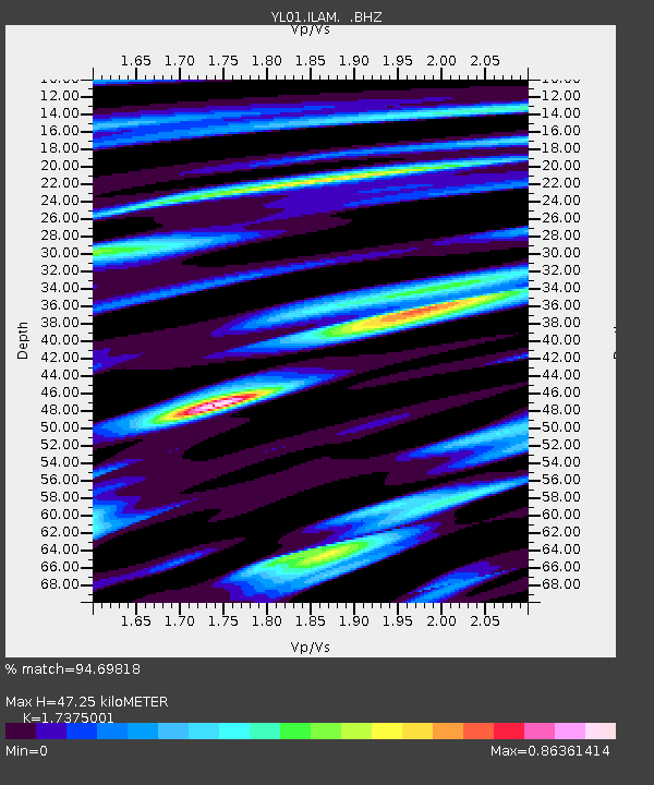
ILAM YL.ILAM - Earthquake Result Viewer
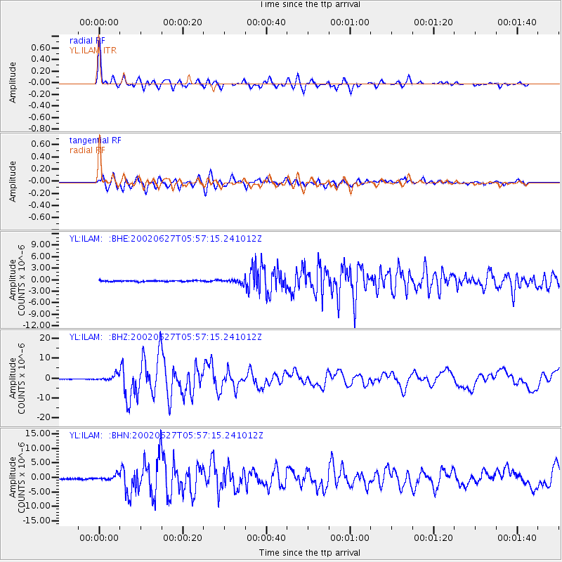
Earthquake location: Sunda Strait, Indonesia
Earthquake latitude/longitude: -7.0/104.2
Earthquake time(UTC): 2002/06/27 (178) 05:50:35 GMT
Earthquake Depth: 11 km
Earthquake Magnitude: 6.0 MB, 6.9 MS, 6.6 MW, 6.5 MW
Earthquake Catalog/Contributor: WHDF/NEIC
Network: YL Himalayan Nepal Tibet Experiment
Station: ILAM YL.ILAM
Lat/Lon: 26.91 N/87.92 E
Elevation: 1181 m
Distance: 37.2 deg
Az: 335.562 deg
Baz: 152.617 deg
Ray Param: 0.07627579
Estimated Moho Depth: 47.25 km
Estimated Crust Vp/Vs: 1.74
Assumed Crust Vp: 6.236 km/s
Estimated Crust Vs: 3.589 km/s
Estimated Crust Poisson's Ratio: 0.25
Radial Match: 94.69818 %
Radial Bump: 400
Transverse Match: 80.12674 %
Transverse Bump: 400
SOD ConfigId: 16844
Insert Time: 2010-02-26 15:56:35.878 +0000
GWidth: 2.5
Max Bumps: 400
Tol: 0.001

Signal To Noise

ChannelStoNSTALTA
YL:ILAM: :BHZ:20020627T05:57:15.241012Z17.1906221.5676329E-69.119117E-8
YL:ILAM: :BHN:20020627T05:57:15.241012Z2.39634568.476058E-73.537077E-7
YL:ILAM: :BHE:20020627T05:57:15.241012Z4.43533665.2037416E-71.1732461E-7
Arrivals
Ps6.0 SECOND
PpPs19 SECOND
PsPs/PpSs25 SECOND