You are here: Home > Network List > US - United States National Seismic Network Stations List
> Station MSO Missoula, Montana, USA > Earthquake Result Viewer
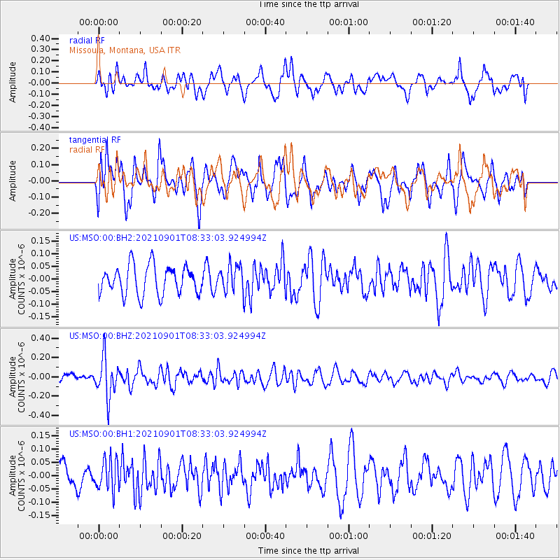
MSO Missoula, Montana, USA - Earthquake Result Viewer
*The percent match for this event was below the threshold and hence no stack was calculated.
| Earthquake location: |
Tonga Islands |
| Earthquake latitude/longitude: |
-18.7/-174.1 |
| Earthquake time(UTC): |
2021/09/01 (244) 08:21:09 GMT |
| Earthquake Depth: |
75 km |
| Earthquake Magnitude: |
5.2 Mww |
| Earthquake Catalog/Contributor: |
NEIC PDE/us |
|
| Network: |
US United States National Seismic Network |
| Station: |
MSO Missoula, Montana, USA |
| Lat/Lon: |
46.83 N/113.94 W |
| Elevation: |
1264 m |
|
| Distance: |
84.7 deg |
| Az: |
36.731 deg |
| Baz: |
235.635 deg |
| Ray Param: |
$rayparam |
*The percent match for this event was below the threshold and hence was not used in the summary stack. |
|
| Radial Match: |
51.528755 % |
| Radial Bump: |
400 |
| Transverse Match: |
55.338856 % |
| Transverse Bump: |
400 |
| SOD ConfigId: |
25131211 |
| Insert Time: |
2021-09-15 08:43:30.345 +0000 |
| GWidth: |
2.5 |
| Max Bumps: |
400 |
| Tol: |
0.001 |
|
Signal To Noise
| Channel | StoN | STA | LTA |
| US:MSO:00:BHZ:20210901T08:33:03.924994Z | 4.315748 | 2.084667E-7 | 4.8303722E-8 |
| US:MSO:00:BH1:20210901T08:33:03.924994Z | 0.8957707 | 5.9212773E-8 | 6.61026E-8 |
| US:MSO:00:BH2:20210901T08:33:03.924994Z | 0.93189424 | 5.3215093E-8 | 5.710422E-8 |
| Arrivals |
| Ps | |
| PpPs | |
| PsPs/PpSs | |


