You are here: Home > Network List > UW - Pacific Northwest Regional Seismic Network Stations List
> Station IRON Crane, OR, USA > Earthquake Result Viewer
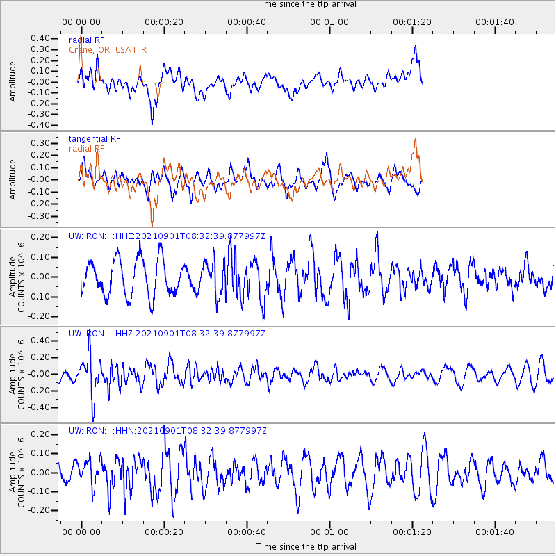
IRON Crane, OR, USA - Earthquake Result Viewer
*The percent match for this event was below the threshold and hence no stack was calculated.
| Earthquake location: |
Tonga Islands |
| Earthquake latitude/longitude: |
-18.7/-174.1 |
| Earthquake time(UTC): |
2021/09/01 (244) 08:21:09 GMT |
| Earthquake Depth: |
75 km |
| Earthquake Magnitude: |
5.2 Mww |
| Earthquake Catalog/Contributor: |
NEIC PDE/us |
|
| Network: |
UW Pacific Northwest Regional Seismic Network |
| Station: |
IRON Crane, OR, USA |
| Lat/Lon: |
43.36 N/118.47 W |
| Elevation: |
1226 m |
|
| Distance: |
80.1 deg |
| Az: |
37.665 deg |
| Baz: |
232.556 deg |
| Ray Param: |
$rayparam |
*The percent match for this event was below the threshold and hence was not used in the summary stack. |
|
| Radial Match: |
41.01973 % |
| Radial Bump: |
400 |
| Transverse Match: |
47.52174 % |
| Transverse Bump: |
345 |
| SOD ConfigId: |
25131211 |
| Insert Time: |
2021-09-15 08:45:06.111 +0000 |
| GWidth: |
2.5 |
| Max Bumps: |
400 |
| Tol: |
0.001 |
|
Signal To Noise
| Channel | StoN | STA | LTA |
| UW:IRON: :HHZ:20210901T08:32:39.877997Z | 3.6372118 | 2.4229155E-7 | 6.661464E-8 |
| UW:IRON: :HHN:20210901T08:32:39.877997Z | 0.98739314 | 6.3887434E-8 | 6.470314E-8 |
| UW:IRON: :HHE:20210901T08:32:39.877997Z | 0.9493477 | 8.501798E-8 | 8.9554106E-8 |
| Arrivals |
| Ps | |
| PpPs | |
| PsPs/PpSs | |


