You are here: Home > Network List > UW - Pacific Northwest Regional Seismic Network Stations List
> Station UMAT Pilot Rock, OR, USA > Earthquake Result Viewer
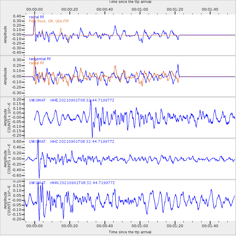
UMAT Pilot Rock, OR, USA - Earthquake Result Viewer
*The percent match for this event was below the threshold and hence no stack was calculated.
| Earthquake location: |
Tonga Islands |
| Earthquake latitude/longitude: |
-18.7/-174.1 |
| Earthquake time(UTC): |
2021/09/01 (244) 08:21:09 GMT |
| Earthquake Depth: |
75 km |
| Earthquake Magnitude: |
5.2 Mww |
| Earthquake Catalog/Contributor: |
NEIC PDE/us |
|
| Network: |
UW Pacific Northwest Regional Seismic Network |
| Station: |
UMAT Pilot Rock, OR, USA |
| Lat/Lon: |
45.29 N/118.96 W |
| Elevation: |
1318 m |
|
| Distance: |
81.0 deg |
| Az: |
35.9 deg |
| Baz: |
231.928 deg |
| Ray Param: |
$rayparam |
*The percent match for this event was below the threshold and hence was not used in the summary stack. |
|
| Radial Match: |
60.678272 % |
| Radial Bump: |
393 |
| Transverse Match: |
68.65265 % |
| Transverse Bump: |
377 |
| SOD ConfigId: |
25131211 |
| Insert Time: |
2021-09-15 08:46:02.995 +0000 |
| GWidth: |
2.5 |
| Max Bumps: |
400 |
| Tol: |
0.001 |
|
Signal To Noise
| Channel | StoN | STA | LTA |
| UW:UMAT: :HHZ:20210901T08:32:44.719977Z | 4.3158855 | 2.7679238E-7 | 6.413339E-8 |
| UW:UMAT: :HHN:20210901T08:32:44.719977Z | 1.6870852 | 9.6821736E-8 | 5.7389954E-8 |
| UW:UMAT: :HHE:20210901T08:32:44.719977Z | 2.2848186 | 9.559011E-8 | 4.183707E-8 |
| Arrivals |
| Ps | |
| PpPs | |
| PsPs/PpSs | |


