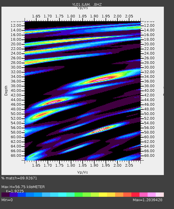
ILAM YL.ILAM - Earthquake Result Viewer
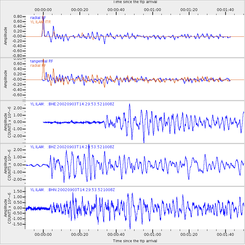
Earthquake location: Mindoro, Philippines
Earthquake latitude/longitude: 13.5/120.8
Earthquake time(UTC): 2002/09/03 (246) 14:23:45 GMT
Earthquake Depth: 10 km
Earthquake Magnitude: 5.5 MB, 5.4 MS, 5.9 MW, 5.8 MW
Earthquake Catalog/Contributor: WHDF/NEIC
Network: YL Himalayan Nepal Tibet Experiment
Station: ILAM YL.ILAM
Lat/Lon: 26.91 N/87.92 E
Elevation: 1181 m
Distance: 33.4 deg
Az: 298.543 deg
Baz: 106.902 deg
Ray Param: 0.07820529
Estimated Moho Depth: 56.75 km
Estimated Crust Vp/Vs: 1.92
Assumed Crust Vp: 6.236 km/s
Estimated Crust Vs: 3.244 km/s
Estimated Crust Poisson's Ratio: 0.31
Radial Match: 89.92671 %
Radial Bump: 400
Transverse Match: 84.95649 %
Transverse Bump: 400
SOD ConfigId: 16844
Insert Time: 2010-02-26 15:56:48.117 +0000
GWidth: 2.5
Max Bumps: 400
Tol: 0.001

Signal To Noise

ChannelStoNSTALTA
YL:ILAM: :BHZ:20020903T14:29:53.521008Z6.36979684.9835955E-77.82379E-8
YL:ILAM: :BHN:20020903T14:29:53.521008Z1.70254241.426248E-78.377166E-8
YL:ILAM: :BHE:20020903T14:29:53.521008Z4.36119652.6068804E-75.977443E-8
Arrivals
Ps9.0 SECOND
PpPs25 SECOND
PsPs/PpSs34 SECOND