You are here: Home > Network List > IW - Intermountain West Stations List
> Station MOOW Moose Ponds, Wyoming, USA > Earthquake Result Viewer
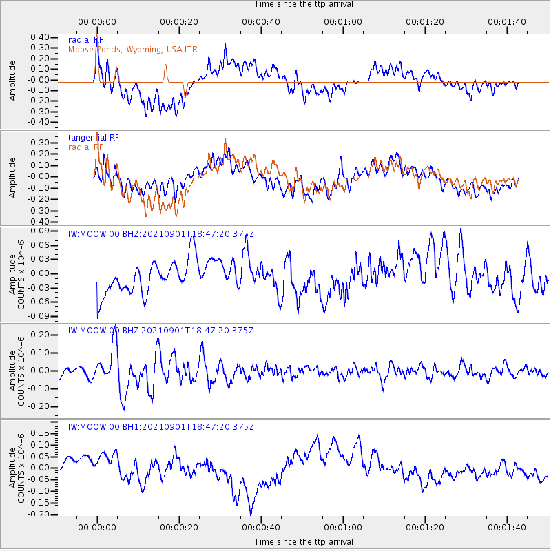
MOOW Moose Ponds, Wyoming, USA - Earthquake Result Viewer
*The percent match for this event was below the threshold and hence no stack was calculated.
| Earthquake location: |
Near Coast Of Northern Chile |
| Earthquake latitude/longitude: |
-27.7/-71.2 |
| Earthquake time(UTC): |
2021/09/01 (244) 18:35:44 GMT |
| Earthquake Depth: |
17 km |
| Earthquake Magnitude: |
5.8 mww |
| Earthquake Catalog/Contributor: |
NEIC PDE/us |
|
| Network: |
IW Intermountain West |
| Station: |
MOOW Moose Ponds, Wyoming, USA |
| Lat/Lon: |
43.75 N/110.74 W |
| Elevation: |
2128 m |
|
| Distance: |
79.8 deg |
| Az: |
332.05 deg |
| Baz: |
145.022 deg |
| Ray Param: |
$rayparam |
*The percent match for this event was below the threshold and hence was not used in the summary stack. |
|
| Radial Match: |
54.99752 % |
| Radial Bump: |
400 |
| Transverse Match: |
33.46933 % |
| Transverse Bump: |
400 |
| SOD ConfigId: |
25131211 |
| Insert Time: |
2021-09-15 18:44:26.532 +0000 |
| GWidth: |
2.5 |
| Max Bumps: |
400 |
| Tol: |
0.001 |
|
Signal To Noise
| Channel | StoN | STA | LTA |
| IW:MOOW:00:BHZ:20210901T18:47:20.375Z | 7.3227305 | 1.0931085E-7 | 1.4927608E-8 |
| IW:MOOW:00:BH1:20210901T18:47:20.375Z | 1.4653318 | 8.50814E-8 | 5.806289E-8 |
| IW:MOOW:00:BH2:20210901T18:47:20.375Z | 0.7906979 | 2.7561283E-8 | 3.485691E-8 |
| Arrivals |
| Ps | |
| PpPs | |
| PsPs/PpSs | |


