You are here: Home > Network List > US - United States National Seismic Network Stations List
> Station CBKS Cedar Bluff, Kansas, USA > Earthquake Result Viewer
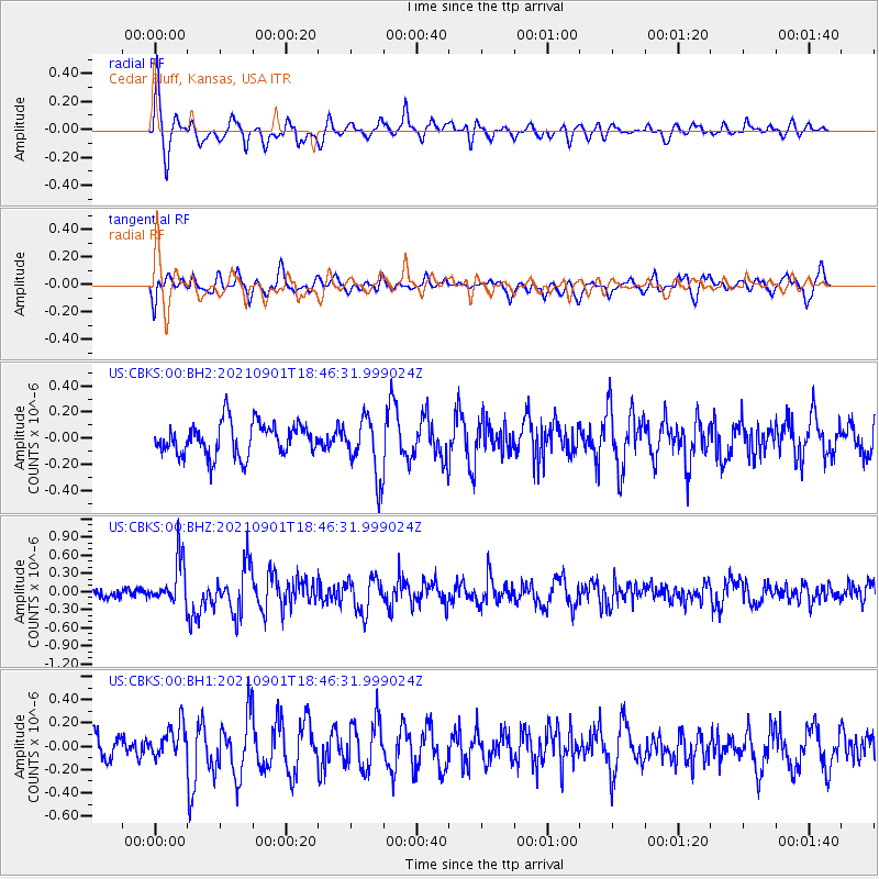
CBKS Cedar Bluff, Kansas, USA - Earthquake Result Viewer
*The percent match for this event was below the threshold and hence no stack was calculated.
| Earthquake location: |
Near Coast Of Northern Chile |
| Earthquake latitude/longitude: |
-27.7/-71.2 |
| Earthquake time(UTC): |
2021/09/01 (244) 18:35:44 GMT |
| Earthquake Depth: |
17 km |
| Earthquake Magnitude: |
5.8 mww |
| Earthquake Catalog/Contributor: |
NEIC PDE/us |
|
| Network: |
US United States National Seismic Network |
| Station: |
CBKS Cedar Bluff, Kansas, USA |
| Lat/Lon: |
38.81 N/99.74 W |
| Elevation: |
677 m |
|
| Distance: |
71.4 deg |
| Az: |
336.81 deg |
| Baz: |
153.463 deg |
| Ray Param: |
$rayparam |
*The percent match for this event was below the threshold and hence was not used in the summary stack. |
|
| Radial Match: |
64.12183 % |
| Radial Bump: |
400 |
| Transverse Match: |
44.854218 % |
| Transverse Bump: |
400 |
| SOD ConfigId: |
25131211 |
| Insert Time: |
2021-09-15 18:55:20.255 +0000 |
| GWidth: |
2.5 |
| Max Bumps: |
400 |
| Tol: |
0.001 |
|
Signal To Noise
| Channel | StoN | STA | LTA |
| US:CBKS:00:BHZ:20210901T18:46:31.999024Z | 5.42811 | 3.7532928E-7 | 6.914548E-8 |
| US:CBKS:00:BH1:20210901T18:46:31.999024Z | 1.3337336 | 1.3817194E-7 | 1.03597856E-7 |
| US:CBKS:00:BH2:20210901T18:46:31.999024Z | 1.7931237 | 2.2456105E-7 | 1.2523455E-7 |
| Arrivals |
| Ps | |
| PpPs | |
| PsPs/PpSs | |


