You are here: Home > Network List > US - United States National Seismic Network Stations List
> Station DUG Dugway, Tooele County, Utah, USA > Earthquake Result Viewer
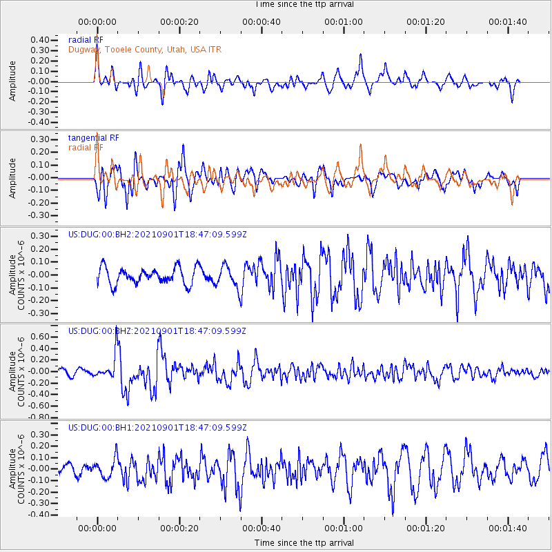
DUG Dugway, Tooele County, Utah, USA - Earthquake Result Viewer
*The percent match for this event was below the threshold and hence no stack was calculated.
| Earthquake location: |
Near Coast Of Northern Chile |
| Earthquake latitude/longitude: |
-27.7/-71.2 |
| Earthquake time(UTC): |
2021/09/01 (244) 18:35:44 GMT |
| Earthquake Depth: |
17 km |
| Earthquake Magnitude: |
5.8 mww |
| Earthquake Catalog/Contributor: |
NEIC PDE/us |
|
| Network: |
US United States National Seismic Network |
| Station: |
DUG Dugway, Tooele County, Utah, USA |
| Lat/Lon: |
40.19 N/112.81 W |
| Elevation: |
1477 m |
|
| Distance: |
77.9 deg |
| Az: |
328.652 deg |
| Baz: |
142.986 deg |
| Ray Param: |
$rayparam |
*The percent match for this event was below the threshold and hence was not used in the summary stack. |
|
| Radial Match: |
71.217606 % |
| Radial Bump: |
400 |
| Transverse Match: |
78.36096 % |
| Transverse Bump: |
400 |
| SOD ConfigId: |
25131211 |
| Insert Time: |
2021-09-15 18:55:24.089 +0000 |
| GWidth: |
2.5 |
| Max Bumps: |
400 |
| Tol: |
0.001 |
|
Signal To Noise
| Channel | StoN | STA | LTA |
| US:DUG:00:BHZ:20210901T18:47:09.599Z | 2.8290832 | 2.2953392E-7 | 8.113368E-8 |
| US:DUG:00:BH1:20210901T18:47:09.599Z | 0.98672783 | 8.646109E-8 | 8.762406E-8 |
| US:DUG:00:BH2:20210901T18:47:09.599Z | 1.3675299 | 8.669946E-8 | 6.339859E-8 |
| Arrivals |
| Ps | |
| PpPs | |
| PsPs/PpSs | |


