You are here: Home > Network List > UW - Pacific Northwest Regional Seismic Network Stations List
> Station UMAT Pilot Rock, OR, USA > Earthquake Result Viewer
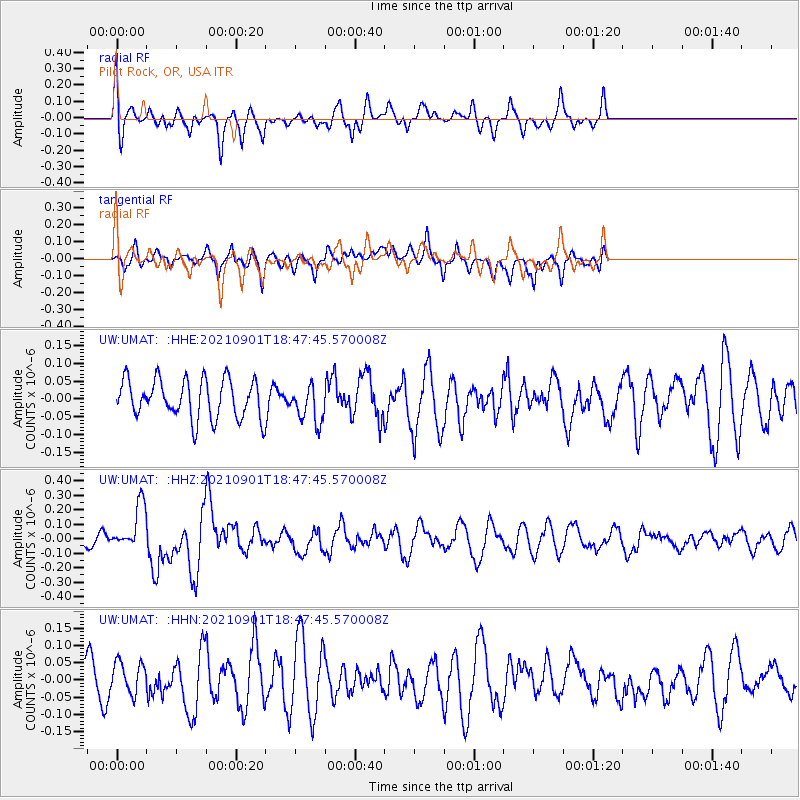
UMAT Pilot Rock, OR, USA - Earthquake Result Viewer
*The percent match for this event was below the threshold and hence no stack was calculated.
| Earthquake location: |
Near Coast Of Northern Chile |
| Earthquake latitude/longitude: |
-27.7/-71.2 |
| Earthquake time(UTC): |
2021/09/01 (244) 18:35:44 GMT |
| Earthquake Depth: |
17 km |
| Earthquake Magnitude: |
5.8 mww |
| Earthquake Catalog/Contributor: |
NEIC PDE/us |
|
| Network: |
UW Pacific Northwest Regional Seismic Network |
| Station: |
UMAT Pilot Rock, OR, USA |
| Lat/Lon: |
45.29 N/118.96 W |
| Elevation: |
1318 m |
|
| Distance: |
84.7 deg |
| Az: |
328.344 deg |
| Baz: |
138.776 deg |
| Ray Param: |
$rayparam |
*The percent match for this event was below the threshold and hence was not used in the summary stack. |
|
| Radial Match: |
63.091988 % |
| Radial Bump: |
400 |
| Transverse Match: |
55.342293 % |
| Transverse Bump: |
400 |
| SOD ConfigId: |
25131211 |
| Insert Time: |
2021-09-15 18:57:59.749 +0000 |
| GWidth: |
2.5 |
| Max Bumps: |
400 |
| Tol: |
0.001 |
|
Signal To Noise
| Channel | StoN | STA | LTA |
| UW:UMAT: :HHZ:20210901T18:47:45.570008Z | 6.073673 | 1.5741058E-7 | 2.5916869E-8 |
| UW:UMAT: :HHN:20210901T18:47:45.570008Z | 1.007185 | 4.6430966E-8 | 4.6099743E-8 |
| UW:UMAT: :HHE:20210901T18:47:45.570008Z | 0.96791786 | 5.264005E-8 | 5.438483E-8 |
| Arrivals |
| Ps | |
| PpPs | |
| PsPs/PpSs | |


