You are here: Home > Network List > WY - Yellowstone Wyoming Seismic Network Stations List
> Station YHH Holmes Hill, YNP, WY, USA > Earthquake Result Viewer
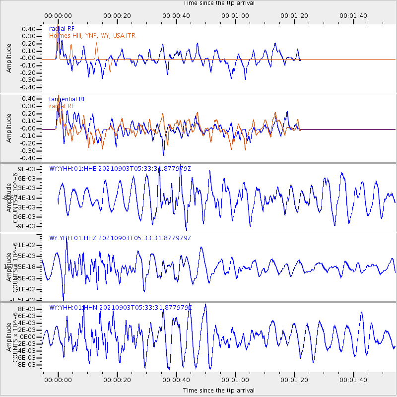
YHH Holmes Hill, YNP, WY, USA - Earthquake Result Viewer
*The percent match for this event was below the threshold and hence no stack was calculated.
| Earthquake location: |
Southern East Pacific Rise |
| Earthquake latitude/longitude: |
-24.3/-116.0 |
| Earthquake time(UTC): |
2021/09/03 (246) 05:22:58 GMT |
| Earthquake Depth: |
10 km |
| Earthquake Magnitude: |
5.4 Mww |
| Earthquake Catalog/Contributor: |
NEIC PDE/us |
|
| Network: |
WY Yellowstone Wyoming Seismic Network |
| Station: |
YHH Holmes Hill, YNP, WY, USA |
| Lat/Lon: |
44.79 N/110.85 W |
| Elevation: |
2717 m |
|
| Distance: |
68.9 deg |
| Az: |
3.905 deg |
| Baz: |
185.007 deg |
| Ray Param: |
$rayparam |
*The percent match for this event was below the threshold and hence was not used in the summary stack. |
|
| Radial Match: |
61.392498 % |
| Radial Bump: |
400 |
| Transverse Match: |
68.33679 % |
| Transverse Bump: |
400 |
| SOD ConfigId: |
25131211 |
| Insert Time: |
2021-09-17 05:44:55.716 +0000 |
| GWidth: |
2.5 |
| Max Bumps: |
400 |
| Tol: |
0.001 |
|
Signal To Noise
| Channel | StoN | STA | LTA |
| WY:YHH:01:HHZ:20210903T05:33:31.877979Z | 1.658756 | 6.518982E-9 | 3.9300425E-9 |
| WY:YHH:01:HHN:20210903T05:33:31.877979Z | 1.0234423 | 2.7964642E-9 | 2.73241E-9 |
| WY:YHH:01:HHE:20210903T05:33:31.877979Z | 1.9683175 | 5.58335E-9 | 2.8366103E-9 |
| Arrivals |
| Ps | |
| PpPs | |
| PsPs/PpSs | |


