You are here: Home > Network List > CI - Caltech Regional Seismic Network Stations List
> Station MPM Manuel Prospect Mine, California, USA > Earthquake Result Viewer
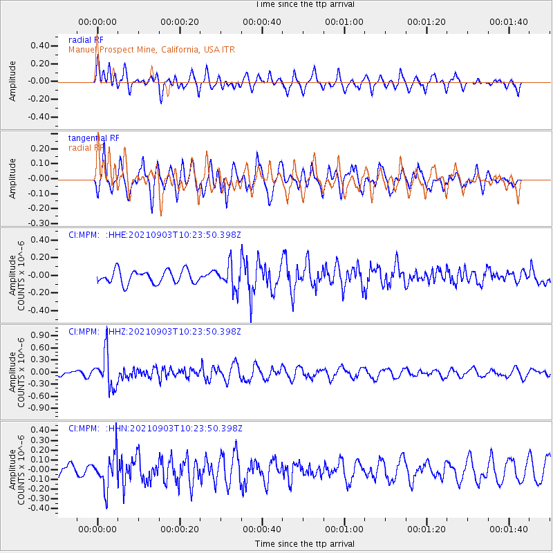
MPM Manuel Prospect Mine, California, USA - Earthquake Result Viewer
*The percent match for this event was below the threshold and hence no stack was calculated.
| Earthquake location: |
Sea Of Okhotsk |
| Earthquake latitude/longitude: |
49.5/147.0 |
| Earthquake time(UTC): |
2021/09/03 (246) 10:14:26 GMT |
| Earthquake Depth: |
582 km |
| Earthquake Magnitude: |
5.8 Mww |
| Earthquake Catalog/Contributor: |
NEIC PDE/us |
|
| Network: |
CI Caltech Regional Seismic Network |
| Station: |
MPM Manuel Prospect Mine, California, USA |
| Lat/Lon: |
36.06 N/117.49 W |
| Elevation: |
185 m |
|
| Distance: |
66.8 deg |
| Az: |
61.31 deg |
| Baz: |
315.072 deg |
| Ray Param: |
$rayparam |
*The percent match for this event was below the threshold and hence was not used in the summary stack. |
|
| Radial Match: |
65.05201 % |
| Radial Bump: |
400 |
| Transverse Match: |
72.64317 % |
| Transverse Bump: |
400 |
| SOD ConfigId: |
25131211 |
| Insert Time: |
2021-09-17 10:25:27.085 +0000 |
| GWidth: |
2.5 |
| Max Bumps: |
400 |
| Tol: |
0.001 |
|
Signal To Noise
| Channel | StoN | STA | LTA |
| CI:MPM: :HHZ:20210903T10:23:50.398Z | 5.002521 | 4.4230376E-7 | 8.8416165E-8 |
| CI:MPM: :HHN:20210903T10:23:50.398Z | 2.2351065 | 1.8001342E-7 | 8.053908E-8 |
| CI:MPM: :HHE:20210903T10:23:50.398Z | 1.9046843 | 1.4010341E-7 | 7.355728E-8 |
| Arrivals |
| Ps | |
| PpPs | |
| PsPs/PpSs | |


