You are here: Home > Network List > CI - Caltech Regional Seismic Network Stations List
> Station SWS Sam W. Stewart, Westmorland, CA, USA > Earthquake Result Viewer
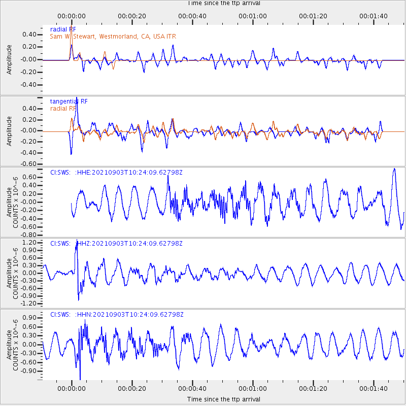
SWS Sam W. Stewart, Westmorland, CA, USA - Earthquake Result Viewer
*The percent match for this event was below the threshold and hence no stack was calculated.
| Earthquake location: |
Sea Of Okhotsk |
| Earthquake latitude/longitude: |
49.5/147.0 |
| Earthquake time(UTC): |
2021/09/03 (246) 10:14:26 GMT |
| Earthquake Depth: |
582 km |
| Earthquake Magnitude: |
5.8 Mww |
| Earthquake Catalog/Contributor: |
NEIC PDE/us |
|
| Network: |
CI Caltech Regional Seismic Network |
| Station: |
SWS Sam W. Stewart, Westmorland, CA, USA |
| Lat/Lon: |
32.94 N/115.80 W |
| Elevation: |
140 m |
|
| Distance: |
70.0 deg |
| Az: |
62.563 deg |
| Baz: |
316.488 deg |
| Ray Param: |
$rayparam |
*The percent match for this event was below the threshold and hence was not used in the summary stack. |
|
| Radial Match: |
44.914143 % |
| Radial Bump: |
400 |
| Transverse Match: |
69.32776 % |
| Transverse Bump: |
330 |
| SOD ConfigId: |
25131211 |
| Insert Time: |
2021-09-17 10:26:00.757 +0000 |
| GWidth: |
2.5 |
| Max Bumps: |
400 |
| Tol: |
0.001 |
|
Signal To Noise
| Channel | StoN | STA | LTA |
| CI:SWS: :HHZ:20210903T10:24:09.62798Z | 3.024532 | 5.6353E-7 | 1.8631974E-7 |
| CI:SWS: :HHN:20210903T10:24:09.62798Z | 1.8737218 | 4.340848E-7 | 2.3166983E-7 |
| CI:SWS: :HHE:20210903T10:24:09.62798Z | 1.0639277 | 2.5831756E-7 | 2.4279618E-7 |
| Arrivals |
| Ps | |
| PpPs | |
| PsPs/PpSs | |


