You are here: Home > Network List > CN - Canadian National Seismograph Network Stations List
> Station INK INUVIK, NT > Earthquake Result Viewer
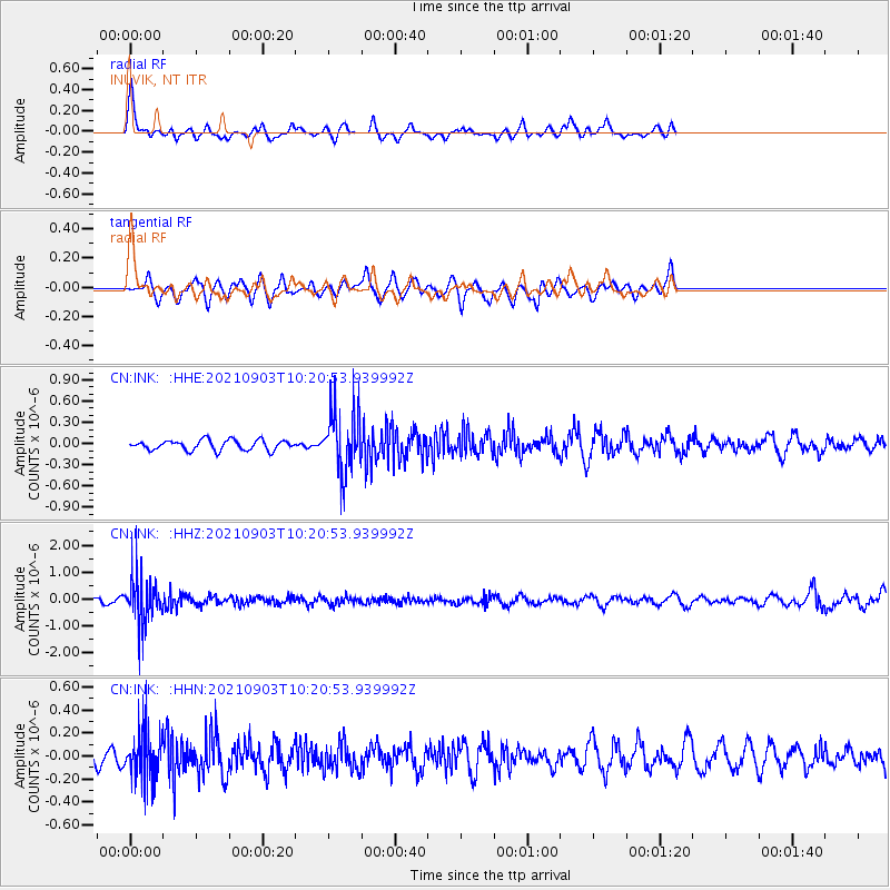
INK INUVIK, NT - Earthquake Result Viewer
*The percent match for this event was below the threshold and hence no stack was calculated.
| Earthquake location: |
Sea Of Okhotsk |
| Earthquake latitude/longitude: |
49.5/147.0 |
| Earthquake time(UTC): |
2021/09/03 (246) 10:14:26 GMT |
| Earthquake Depth: |
582 km |
| Earthquake Magnitude: |
5.8 Mww |
| Earthquake Catalog/Contributor: |
NEIC PDE/us |
|
| Network: |
CN Canadian National Seismograph Network |
| Station: |
INK INUVIK, NT |
| Lat/Lon: |
68.31 N/133.53 W |
| Elevation: |
44 m |
|
| Distance: |
41.6 deg |
| Az: |
33.411 deg |
| Baz: |
284.953 deg |
| Ray Param: |
$rayparam |
*The percent match for this event was below the threshold and hence was not used in the summary stack. |
|
| Radial Match: |
51.441723 % |
| Radial Bump: |
308 |
| Transverse Match: |
43.396133 % |
| Transverse Bump: |
341 |
| SOD ConfigId: |
25131211 |
| Insert Time: |
2021-09-17 10:27:05.000 +0000 |
| GWidth: |
2.5 |
| Max Bumps: |
400 |
| Tol: |
0.001 |
|
Signal To Noise
| Channel | StoN | STA | LTA |
| CN:INK: :HHZ:20210903T10:20:53.939992Z | 12.471529 | 8.9655884E-7 | 7.1888444E-8 |
| CN:INK: :HHN:20210903T10:20:53.939992Z | 1.8003967 | 2.1807261E-7 | 1.2112476E-7 |
| CN:INK: :HHE:20210903T10:20:53.939992Z | 6.0916176 | 4.304032E-7 | 7.065499E-8 |
| Arrivals |
| Ps | |
| PpPs | |
| PsPs/PpSs | |


