You are here: Home > Network List > PF - Volcanologic Network of Piton de Fournaise-OVPF Stations List
> Station CIL Cilaos (Pompiers) > Earthquake Result Viewer
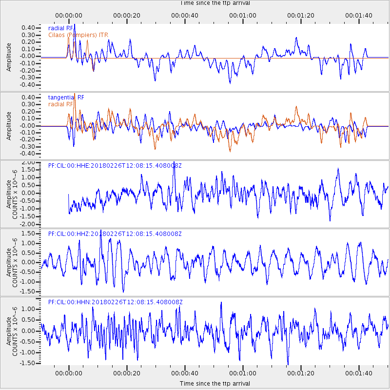
CIL Cilaos (Pompiers) - Earthquake Result Viewer
*The percent match for this event was below the threshold and hence no stack was calculated.
| Earthquake location: |
New Guinea, Papua New Guinea |
| Earthquake latitude/longitude: |
-6.5/143.6 |
| Earthquake time(UTC): |
2018/02/26 (057) 11:56:07 GMT |
| Earthquake Depth: |
13 km |
| Earthquake Magnitude: |
5.7 Mww |
| Earthquake Catalog/Contributor: |
NEIC PDE/us |
|
| Network: |
PF Volcanologic Network of Piton de Fournaise-OVPF |
| Station: |
CIL Cilaos (Pompiers) |
| Lat/Lon: |
21.13 S/55.47 E |
| Elevation: |
1223 m |
|
| Distance: |
85.9 deg |
| Az: |
249.295 deg |
| Baz: |
95.355 deg |
| Ray Param: |
$rayparam |
*The percent match for this event was below the threshold and hence was not used in the summary stack. |
|
| Radial Match: |
46.728912 % |
| Radial Bump: |
400 |
| Transverse Match: |
44.56819 % |
| Transverse Bump: |
400 |
| SOD ConfigId: |
2546091 |
| Insert Time: |
2018-03-12 11:58:57.657 +0000 |
| GWidth: |
2.5 |
| Max Bumps: |
400 |
| Tol: |
0.001 |
|
Signal To Noise
| Channel | StoN | STA | LTA |
| PF:CIL:00:HHZ:20180226T12:08:15.408008Z | 2.3248675 | 5.685826E-7 | 2.445656E-7 |
| PF:CIL:00:HHN:20180226T12:08:15.408008Z | 1.3121552 | 4.459422E-7 | 3.3985475E-7 |
| PF:CIL:00:HHE:20180226T12:08:15.408008Z | 1.4104639 | 5.9849464E-7 | 4.243247E-7 |
| Arrivals |
| Ps | |
| PpPs | |
| PsPs/PpSs | |


