You are here: Home > Network List > IW - Intermountain West Stations List
> Station MOOW Moose Ponds, Wyoming, USA > Earthquake Result Viewer
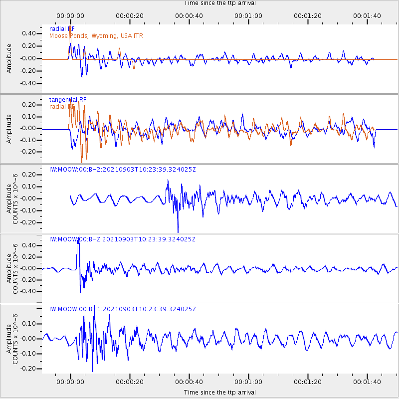
MOOW Moose Ponds, Wyoming, USA - Earthquake Result Viewer
*The percent match for this event was below the threshold and hence no stack was calculated.
| Earthquake location: |
Sea Of Okhotsk |
| Earthquake latitude/longitude: |
49.5/147.0 |
| Earthquake time(UTC): |
2021/09/03 (246) 10:14:26 GMT |
| Earthquake Depth: |
582 km |
| Earthquake Magnitude: |
5.8 Mww |
| Earthquake Catalog/Contributor: |
NEIC PDE/us |
|
| Network: |
IW Intermountain West |
| Station: |
MOOW Moose Ponds, Wyoming, USA |
| Lat/Lon: |
43.75 N/110.74 W |
| Elevation: |
2128 m |
|
| Distance: |
65.1 deg |
| Az: |
51.356 deg |
| Baz: |
315.328 deg |
| Ray Param: |
$rayparam |
*The percent match for this event was below the threshold and hence was not used in the summary stack. |
|
| Radial Match: |
63.9123 % |
| Radial Bump: |
400 |
| Transverse Match: |
53.554676 % |
| Transverse Bump: |
400 |
| SOD ConfigId: |
25131211 |
| Insert Time: |
2021-09-17 10:31:57.176 +0000 |
| GWidth: |
2.5 |
| Max Bumps: |
400 |
| Tol: |
0.001 |
|
Signal To Noise
| Channel | StoN | STA | LTA |
| IW:MOOW:00:BHZ:20210903T10:23:39.324025Z | 8.542654 | 2.3043862E-7 | 2.697506E-8 |
| IW:MOOW:00:BH1:20210903T10:23:39.324025Z | 3.0394049 | 6.2569896E-8 | 2.0586233E-8 |
| IW:MOOW:00:BH2:20210903T10:23:39.324025Z | 2.2625582 | 5.6034256E-8 | 2.4765884E-8 |
| Arrivals |
| Ps | |
| PpPs | |
| PsPs/PpSs | |


