You are here: Home > Network List > US - United States National Seismic Network Stations List
> Station DGMT Dagmar, Montana, USA > Earthquake Result Viewer
DGMT Dagmar, Montana, USA - Earthquake Result Viewer
*The percent match for this event was below the threshold and hence no stack was calculated.
| Earthquake location: |
Sea Of Okhotsk |
| Earthquake latitude/longitude: |
49.5/147.0 |
| Earthquake time(UTC): |
2021/09/03 (246) 10:14:26 GMT |
| Earthquake Depth: |
582 km |
| Earthquake Magnitude: |
5.8 Mww |
| Earthquake Catalog/Contributor: |
NEIC PDE/us |
|
| Network: |
US United States National Seismic Network |
| Station: |
DGMT Dagmar, Montana, USA |
| Lat/Lon: |
48.47 N/104.20 W |
| Elevation: |
0.0 m |
|
| Distance: |
64.8 deg |
| Az: |
44.12 deg |
| Baz: |
316.97 deg |
| Ray Param: |
$rayparam |
*The percent match for this event was below the threshold and hence was not used in the summary stack. |
|
| Radial Match: |
54.800224 % |
| Radial Bump: |
363 |
| Transverse Match: |
83.281685 % |
| Transverse Bump: |
274 |
| SOD ConfigId: |
25131211 |
| Insert Time: |
2021-09-17 10:45:11.314 +0000 |
| GWidth: |
2.5 |
| Max Bumps: |
400 |
| Tol: |
0.001 |
|
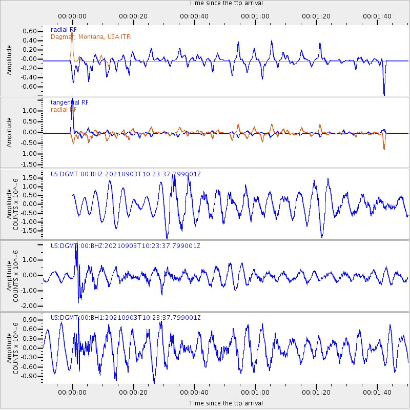
Signal To Noise
| Channel | StoN | STA | LTA |
| US:DGMT:00:BHZ:20210903T10:23:37.799001Z | 2.7413123 | 9.058865E-7 | 3.3045725E-7 |
| US:DGMT:00:BH1:20210903T10:23:37.799001Z | 0.8554675 | 3.716922E-7 | 4.3449015E-7 |
| US:DGMT:00:BH2:20210903T10:23:37.799001Z | 1.9162825 | 1.1202005E-6 | 5.845696E-7 |
| Arrivals |
| Ps | |
| PpPs | |
| PsPs/PpSs | |


