You are here: Home > Network List > US - United States National Seismic Network Stations List
> Station LAO LASA Array, Montana, USA > Earthquake Result Viewer
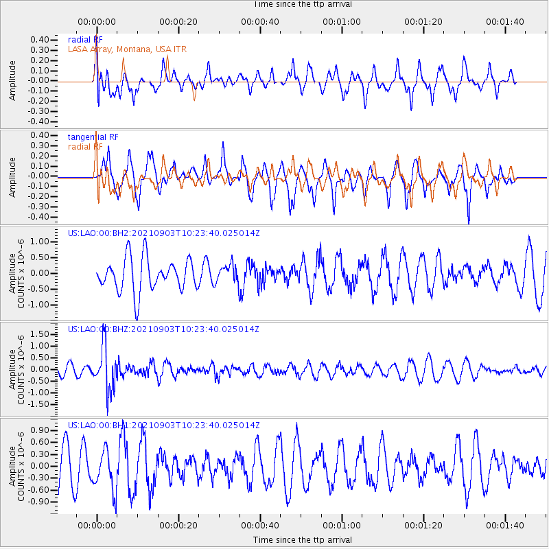
LAO LASA Array, Montana, USA - Earthquake Result Viewer
*The percent match for this event was below the threshold and hence no stack was calculated.
| Earthquake location: |
Sea Of Okhotsk |
| Earthquake latitude/longitude: |
49.5/147.0 |
| Earthquake time(UTC): |
2021/09/03 (246) 10:14:26 GMT |
| Earthquake Depth: |
582 km |
| Earthquake Magnitude: |
5.8 Mww |
| Earthquake Catalog/Contributor: |
NEIC PDE/us |
|
| Network: |
US United States National Seismic Network |
| Station: |
LAO LASA Array, Montana, USA |
| Lat/Lon: |
46.69 N/106.22 W |
| Elevation: |
902 m |
|
| Distance: |
65.2 deg |
| Az: |
46.571 deg |
| Baz: |
316.514 deg |
| Ray Param: |
$rayparam |
*The percent match for this event was below the threshold and hence was not used in the summary stack. |
|
| Radial Match: |
37.53592 % |
| Radial Bump: |
372 |
| Transverse Match: |
44.228024 % |
| Transverse Bump: |
310 |
| SOD ConfigId: |
25131211 |
| Insert Time: |
2021-09-17 10:45:32.065 +0000 |
| GWidth: |
2.5 |
| Max Bumps: |
400 |
| Tol: |
0.001 |
|
Signal To Noise
| Channel | StoN | STA | LTA |
| US:LAO:00:BHZ:20210903T10:23:40.025014Z | 4.1331363 | 9.440717E-7 | 2.2841535E-7 |
| US:LAO:00:BH1:20210903T10:23:40.025014Z | 0.6987864 | 5.126114E-7 | 7.3357376E-7 |
| US:LAO:00:BH2:20210903T10:23:40.025014Z | 0.5522823 | 2.8811058E-7 | 5.2167275E-7 |
| Arrivals |
| Ps | |
| PpPs | |
| PsPs/PpSs | |


