You are here: Home > Network List > US - United States National Seismic Network Stations List
> Station MSO Missoula, Montana, USA > Earthquake Result Viewer
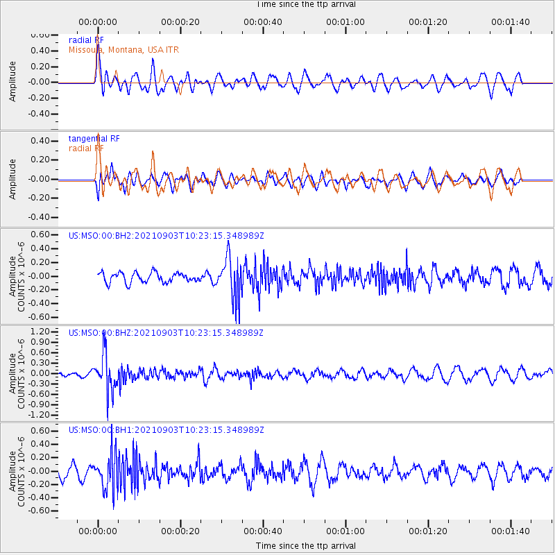
MSO Missoula, Montana, USA - Earthquake Result Viewer
*The percent match for this event was below the threshold and hence no stack was calculated.
| Earthquake location: |
Sea Of Okhotsk |
| Earthquake latitude/longitude: |
49.5/147.0 |
| Earthquake time(UTC): |
2021/09/03 (246) 10:14:26 GMT |
| Earthquake Depth: |
582 km |
| Earthquake Magnitude: |
5.8 Mww |
| Earthquake Catalog/Contributor: |
NEIC PDE/us |
|
| Network: |
US United States National Seismic Network |
| Station: |
MSO Missoula, Montana, USA |
| Lat/Lon: |
46.83 N/113.94 W |
| Elevation: |
1264 m |
|
| Distance: |
61.3 deg |
| Az: |
50.632 deg |
| Baz: |
312.736 deg |
| Ray Param: |
$rayparam |
*The percent match for this event was below the threshold and hence was not used in the summary stack. |
|
| Radial Match: |
63.184925 % |
| Radial Bump: |
400 |
| Transverse Match: |
59.996784 % |
| Transverse Bump: |
400 |
| SOD ConfigId: |
25131211 |
| Insert Time: |
2021-09-17 10:45:41.453 +0000 |
| GWidth: |
2.5 |
| Max Bumps: |
400 |
| Tol: |
0.001 |
|
Signal To Noise
| Channel | StoN | STA | LTA |
| US:MSO:00:BHZ:20210903T10:23:15.348989Z | 5.737007 | 5.4516903E-7 | 9.502673E-8 |
| US:MSO:00:BH1:20210903T10:23:15.348989Z | 2.8994617 | 2.689076E-7 | 9.274397E-8 |
| US:MSO:00:BH2:20210903T10:23:15.348989Z | 4.1686745 | 3.013745E-7 | 7.229505E-8 |
| Arrivals |
| Ps | |
| PpPs | |
| PsPs/PpSs | |


