You are here: Home > Network List > UW - Pacific Northwest Regional Seismic Network Stations List
> Station UMAT Pilot Rock, OR, USA > Earthquake Result Viewer
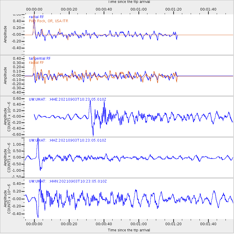
UMAT Pilot Rock, OR, USA - Earthquake Result Viewer
*The percent match for this event was below the threshold and hence no stack was calculated.
| Earthquake location: |
Sea Of Okhotsk |
| Earthquake latitude/longitude: |
49.5/147.0 |
| Earthquake time(UTC): |
2021/09/03 (246) 10:14:26 GMT |
| Earthquake Depth: |
582 km |
| Earthquake Magnitude: |
5.8 Mww |
| Earthquake Catalog/Contributor: |
NEIC PDE/us |
|
| Network: |
UW Pacific Northwest Regional Seismic Network |
| Station: |
UMAT Pilot Rock, OR, USA |
| Lat/Lon: |
45.29 N/118.96 W |
| Elevation: |
1318 m |
|
| Distance: |
59.7 deg |
| Az: |
54.629 deg |
| Baz: |
311.101 deg |
| Ray Param: |
$rayparam |
*The percent match for this event was below the threshold and hence was not used in the summary stack. |
|
| Radial Match: |
79.2739 % |
| Radial Bump: |
400 |
| Transverse Match: |
62.93038 % |
| Transverse Bump: |
400 |
| SOD ConfigId: |
25131211 |
| Insert Time: |
2021-09-17 10:48:42.750 +0000 |
| GWidth: |
2.5 |
| Max Bumps: |
400 |
| Tol: |
0.001 |
|
Signal To Noise
| Channel | StoN | STA | LTA |
| UW:UMAT: :HHZ:20210903T10:23:05.010Z | 8.560564 | 6.3192635E-7 | 7.3818306E-8 |
| UW:UMAT: :HHN:20210903T10:23:05.010Z | 3.6754582 | 2.3735085E-7 | 6.4577215E-8 |
| UW:UMAT: :HHE:20210903T10:23:05.010Z | 5.964776 | 2.6843495E-7 | 4.500336E-8 |
| Arrivals |
| Ps | |
| PpPs | |
| PsPs/PpSs | |


