You are here: Home > Network List > WY - Yellowstone Wyoming Seismic Network Stations List
> Station YHH Holmes Hill, YNP, WY, USA > Earthquake Result Viewer
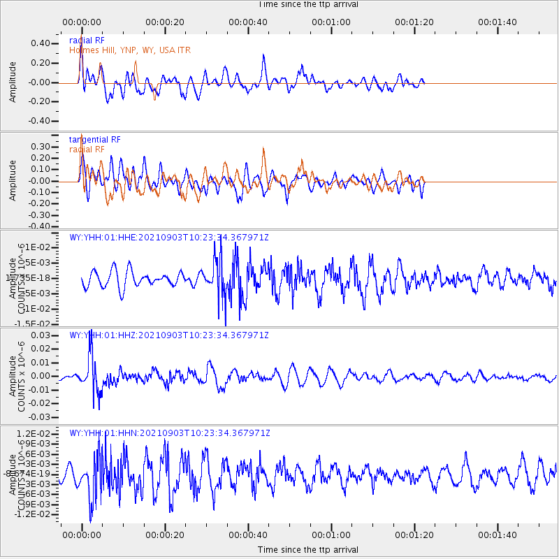
YHH Holmes Hill, YNP, WY, USA - Earthquake Result Viewer
*The percent match for this event was below the threshold and hence no stack was calculated.
| Earthquake location: |
Sea Of Okhotsk |
| Earthquake latitude/longitude: |
49.5/147.0 |
| Earthquake time(UTC): |
2021/09/03 (246) 10:14:26 GMT |
| Earthquake Depth: |
582 km |
| Earthquake Magnitude: |
5.8 Mww |
| Earthquake Catalog/Contributor: |
NEIC PDE/us |
|
| Network: |
WY Yellowstone Wyoming Seismic Network |
| Station: |
YHH Holmes Hill, YNP, WY, USA |
| Lat/Lon: |
44.79 N/110.85 W |
| Elevation: |
2717 m |
|
| Distance: |
64.3 deg |
| Az: |
50.604 deg |
| Baz: |
314.932 deg |
| Ray Param: |
$rayparam |
*The percent match for this event was below the threshold and hence was not used in the summary stack. |
|
| Radial Match: |
63.165768 % |
| Radial Bump: |
400 |
| Transverse Match: |
43.935852 % |
| Transverse Bump: |
400 |
| SOD ConfigId: |
25131211 |
| Insert Time: |
2021-09-17 10:49:45.871 +0000 |
| GWidth: |
2.5 |
| Max Bumps: |
400 |
| Tol: |
0.001 |
|
Signal To Noise
| Channel | StoN | STA | LTA |
| WY:YHH:01:HHZ:20210903T10:23:34.367971Z | 6.84984 | 1.3515487E-8 | 1.97311E-9 |
| WY:YHH:01:HHN:20210903T10:23:34.367971Z | 2.122598 | 6.1475305E-9 | 2.8962293E-9 |
| WY:YHH:01:HHE:20210903T10:23:34.367971Z | 2.4011652 | 6.110184E-9 | 2.5446745E-9 |
| Arrivals |
| Ps | |
| PpPs | |
| PsPs/PpSs | |


