You are here: Home > Network List > CI - Caltech Regional Seismic Network Stations List
> Station MPM Manuel Prospect Mine, California, USA > Earthquake Result Viewer
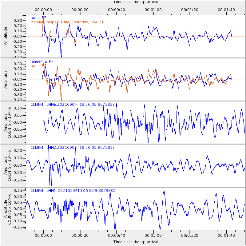
MPM Manuel Prospect Mine, California, USA - Earthquake Result Viewer
*The percent match for this event was below the threshold and hence no stack was calculated.
| Earthquake location: |
Solomon Islands |
| Earthquake latitude/longitude: |
-6.4/154.9 |
| Earthquake time(UTC): |
2021/09/04 (247) 18:43:39 GMT |
| Earthquake Depth: |
60 km |
| Earthquake Magnitude: |
5.4 Mww |
| Earthquake Catalog/Contributor: |
NEIC PDE/us |
|
| Network: |
CI Caltech Regional Seismic Network |
| Station: |
MPM Manuel Prospect Mine, California, USA |
| Lat/Lon: |
36.06 N/117.49 W |
| Elevation: |
185 m |
|
| Distance: |
91.8 deg |
| Az: |
54.093 deg |
| Baz: |
263.446 deg |
| Ray Param: |
$rayparam |
*The percent match for this event was below the threshold and hence was not used in the summary stack. |
|
| Radial Match: |
63.65114 % |
| Radial Bump: |
400 |
| Transverse Match: |
62.137966 % |
| Transverse Bump: |
400 |
| SOD ConfigId: |
25131211 |
| Insert Time: |
2021-09-18 18:51:57.385 +0000 |
| GWidth: |
2.5 |
| Max Bumps: |
400 |
| Tol: |
0.001 |
|
Signal To Noise
| Channel | StoN | STA | LTA |
| CI:MPM: :HHZ:20210904T18:56:09.807983Z | 2.8508906 | 1.2669423E-7 | 4.444023E-8 |
| CI:MPM: :HHN:20210904T18:56:09.807983Z | 1.0047762 | 3.7851525E-8 | 3.7671594E-8 |
| CI:MPM: :HHE:20210904T18:56:09.807983Z | 0.8997963 | 4.423308E-8 | 4.915899E-8 |
| Arrivals |
| Ps | |
| PpPs | |
| PsPs/PpSs | |


