You are here: Home > Network List > CN - Canadian National Seismograph Network Stations List
> Station INK INUVIK, NT > Earthquake Result Viewer
INK INUVIK, NT - Earthquake Result Viewer
*The percent match for this event was below the threshold and hence no stack was calculated.
| Earthquake location: |
Solomon Islands |
| Earthquake latitude/longitude: |
-6.4/154.9 |
| Earthquake time(UTC): |
2021/09/04 (247) 18:43:39 GMT |
| Earthquake Depth: |
60 km |
| Earthquake Magnitude: |
5.4 Mww |
| Earthquake Catalog/Contributor: |
NEIC PDE/us |
|
| Network: |
CN Canadian National Seismograph Network |
| Station: |
INK INUVIK, NT |
| Lat/Lon: |
68.31 N/133.53 W |
| Elevation: |
44 m |
|
| Distance: |
89.2 deg |
| Az: |
20.654 deg |
| Baz: |
250.546 deg |
| Ray Param: |
$rayparam |
*The percent match for this event was below the threshold and hence was not used in the summary stack. |
|
| Radial Match: |
60.122536 % |
| Radial Bump: |
400 |
| Transverse Match: |
48.456833 % |
| Transverse Bump: |
400 |
| SOD ConfigId: |
25131211 |
| Insert Time: |
2021-09-18 18:52:51.266 +0000 |
| GWidth: |
2.5 |
| Max Bumps: |
400 |
| Tol: |
0.001 |
|
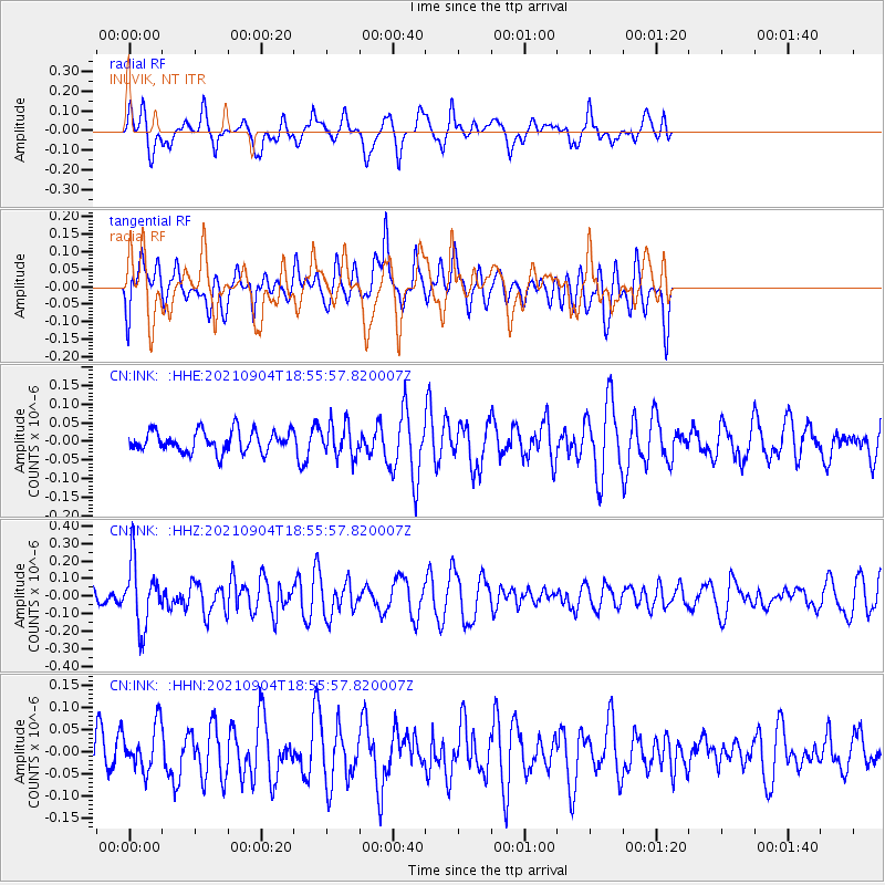
Signal To Noise
| Channel | StoN | STA | LTA |
| CN:INK: :HHZ:20210904T18:55:57.820007Z | 1.7594876 | 1.7822725E-7 | 1.0129498E-7 |
| CN:INK: :HHN:20210904T18:55:57.820007Z | 0.93345743 | 5.135486E-8 | 5.5015747E-8 |
| CN:INK: :HHE:20210904T18:55:57.820007Z | 1.5759573 | 4.4438448E-8 | 2.8197748E-8 |
| Arrivals |
| Ps | |
| PpPs | |
| PsPs/PpSs | |


