You are here: Home > Network List > IU - Global Seismograph Network (GSN - IRIS/USGS) Stations List
> Station JOHN Johnston Island, USA > Earthquake Result Viewer
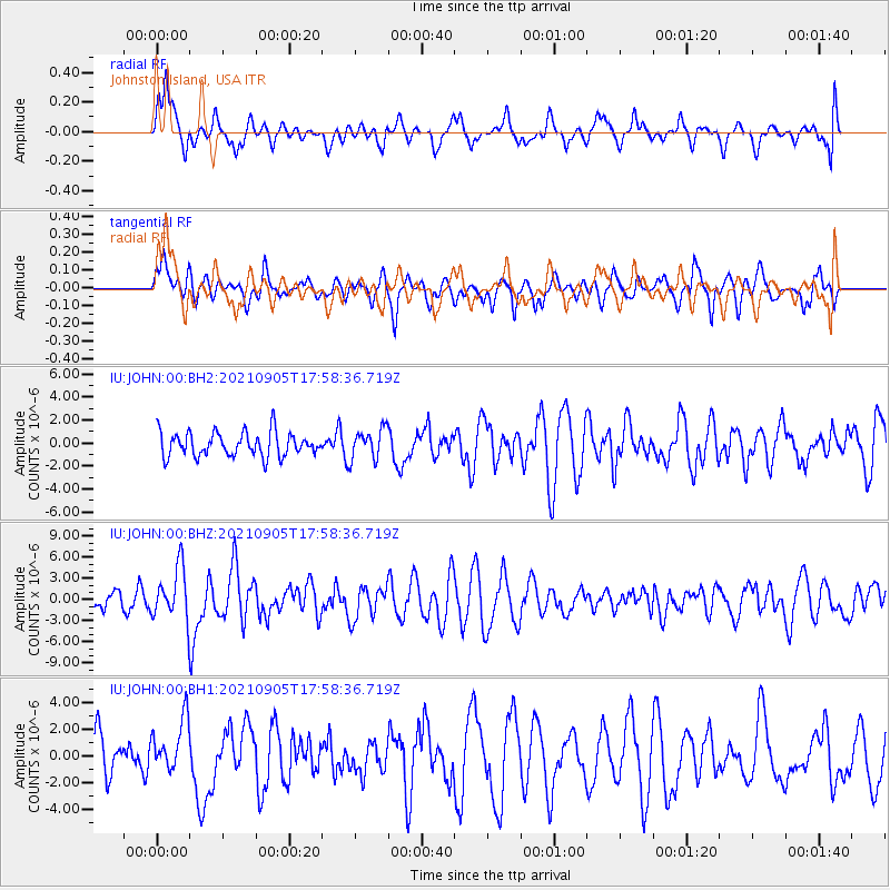
JOHN Johnston Island, USA - Earthquake Result Viewer
*The percent match for this event was below the threshold and hence no stack was calculated.
| Earthquake location: |
Tonga Islands Region |
| Earthquake latitude/longitude: |
-22.1/-174.2 |
| Earthquake time(UTC): |
2021/09/05 (248) 17:51:42 GMT |
| Earthquake Depth: |
10 km |
| Earthquake Magnitude: |
5.9 mww |
| Earthquake Catalog/Contributor: |
NEIC PDE/us |
|
| Network: |
IU Global Seismograph Network (GSN - IRIS/USGS) |
| Station: |
JOHN Johnston Island, USA |
| Lat/Lon: |
16.73 N/169.53 W |
| Elevation: |
2.0 m |
|
| Distance: |
38.8 deg |
| Az: |
7.094 deg |
| Baz: |
186.865 deg |
| Ray Param: |
$rayparam |
*The percent match for this event was below the threshold and hence was not used in the summary stack. |
|
| Radial Match: |
56.29239 % |
| Radial Bump: |
400 |
| Transverse Match: |
60.72371 % |
| Transverse Bump: |
400 |
| SOD ConfigId: |
25131211 |
| Insert Time: |
2021-09-19 18:06:32.087 +0000 |
| GWidth: |
2.5 |
| Max Bumps: |
400 |
| Tol: |
0.001 |
|
Signal To Noise
| Channel | StoN | STA | LTA |
| IU:JOHN:00:BHZ:20210905T17:58:36.719Z | 2.8154643 | 3.6422998E-6 | 1.2936764E-6 |
| IU:JOHN:00:BH1:20210905T17:58:36.719Z | 1.5925064 | 1.9730705E-6 | 1.2389719E-6 |
| IU:JOHN:00:BH2:20210905T17:58:36.719Z | 1.273077 | 1.3212095E-6 | 1.037808E-6 |
| Arrivals |
| Ps | |
| PpPs | |
| PsPs/PpSs | |


