You are here: Home > Network List > PF - Volcanologic Network of Piton de Fournaise-OVPF Stations List
> Station HIM cratere Himiltrude > Earthquake Result Viewer
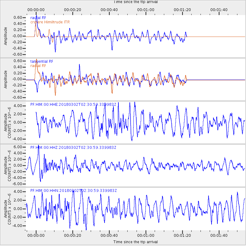
HIM cratere Himiltrude - Earthquake Result Viewer
*The percent match for this event was below the threshold and hence no stack was calculated.
| Earthquake location: |
Banda Sea |
| Earthquake latitude/longitude: |
-6.2/130.3 |
| Earthquake time(UTC): |
2018/03/02 (061) 02:20:12 GMT |
| Earthquake Depth: |
137 km |
| Earthquake Magnitude: |
5.9 Mww |
| Earthquake Catalog/Contributor: |
NEIC PDE/us |
|
| Network: |
PF Volcanologic Network of Piton de Fournaise-OVPF |
| Station: |
HIM cratere Himiltrude |
| Lat/Lon: |
21.21 S/55.72 E |
| Elevation: |
1958 m |
|
| Distance: |
73.4 deg |
| Az: |
249.792 deg |
| Baz: |
90.287 deg |
| Ray Param: |
$rayparam |
*The percent match for this event was below the threshold and hence was not used in the summary stack. |
|
| Radial Match: |
65.540985 % |
| Radial Bump: |
400 |
| Transverse Match: |
60.582634 % |
| Transverse Bump: |
400 |
| SOD ConfigId: |
2615551 |
| Insert Time: |
2018-03-16 02:22:19.416 +0000 |
| GWidth: |
2.5 |
| Max Bumps: |
400 |
| Tol: |
0.001 |
|
Signal To Noise
| Channel | StoN | STA | LTA |
| PF:HIM:00:HHZ:20180302T02:30:59.339983Z | 2.2071323 | 3.0320705E-6 | 1.3737601E-6 |
| PF:HIM:00:HHN:20180302T02:30:59.339983Z | 1.1768159 | 1.9005763E-6 | 1.6150159E-6 |
| PF:HIM:00:HHE:20180302T02:30:59.339983Z | 1.5683962 | 2.3248465E-6 | 1.4823081E-6 |
| Arrivals |
| Ps | |
| PpPs | |
| PsPs/PpSs | |


