You are here: Home > Network List > US - United States National Seismic Network Stations List
> Station DGMT Dagmar, Montana, USA > Earthquake Result Viewer
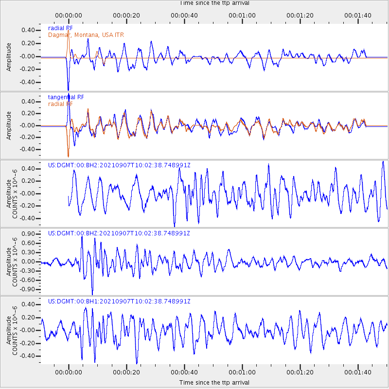
DGMT Dagmar, Montana, USA - Earthquake Result Viewer
*The percent match for this event was below the threshold and hence no stack was calculated.
| Earthquake location: |
Fiji Islands Region |
| Earthquake latitude/longitude: |
-19.4/-176.1 |
| Earthquake time(UTC): |
2021/09/07 (250) 09:49:57 GMT |
| Earthquake Depth: |
10 km |
| Earthquake Magnitude: |
5.8 mww |
| Earthquake Catalog/Contributor: |
NEIC PDE/us |
|
| Network: |
US United States National Seismic Network |
| Station: |
DGMT Dagmar, Montana, USA |
| Lat/Lon: |
48.47 N/104.20 W |
| Elevation: |
0.0 m |
|
| Distance: |
92.9 deg |
| Az: |
39.292 deg |
| Baz: |
243.917 deg |
| Ray Param: |
$rayparam |
*The percent match for this event was below the threshold and hence was not used in the summary stack. |
|
| Radial Match: |
68.8534 % |
| Radial Bump: |
386 |
| Transverse Match: |
63.722435 % |
| Transverse Bump: |
400 |
| SOD ConfigId: |
25131211 |
| Insert Time: |
2021-09-21 10:12:18.481 +0000 |
| GWidth: |
2.5 |
| Max Bumps: |
400 |
| Tol: |
0.001 |
|
Signal To Noise
| Channel | StoN | STA | LTA |
| US:DGMT:00:BHZ:20210907T10:02:38.748991Z | 2.9393182 | 2.5317667E-7 | 8.6134484E-8 |
| US:DGMT:00:BH1:20210907T10:02:38.748991Z | 1.3637854 | 1.4200815E-7 | 1.0412793E-7 |
| US:DGMT:00:BH2:20210907T10:02:38.748991Z | 0.34406006 | 6.1116715E-8 | 1.7763385E-7 |
| Arrivals |
| Ps | |
| PpPs | |
| PsPs/PpSs | |


