You are here: Home > Network List > IW - Intermountain West Stations List
> Station MOOW Moose Ponds, Wyoming, USA > Earthquake Result Viewer
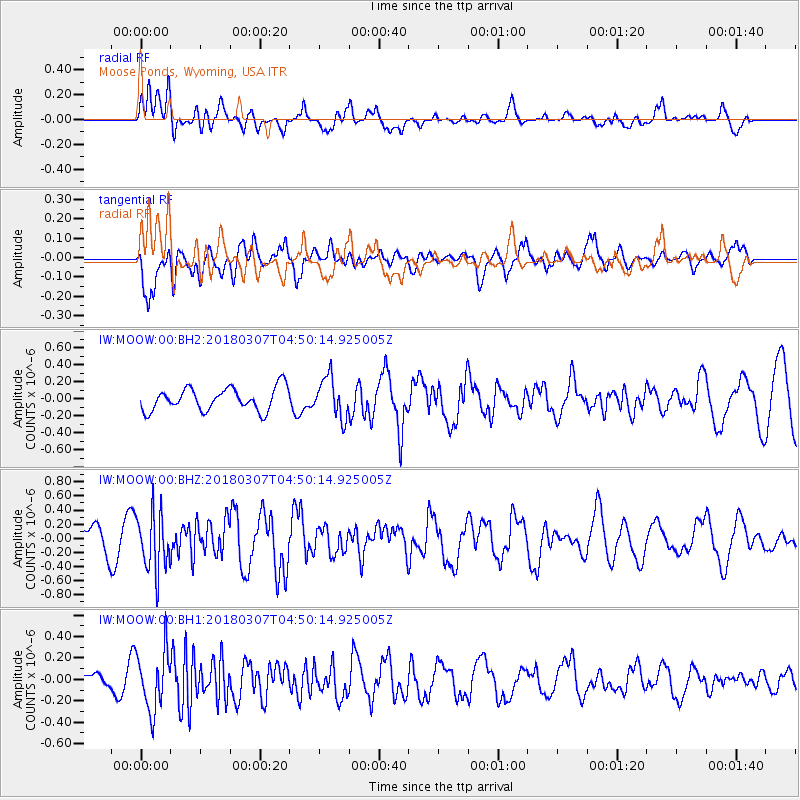
MOOW Moose Ponds, Wyoming, USA - Earthquake Result Viewer
*The percent match for this event was below the threshold and hence no stack was calculated.
| Earthquake location: |
East Of Kuril Islands |
| Earthquake latitude/longitude: |
45.8/152.3 |
| Earthquake time(UTC): |
2018/03/07 (066) 04:40:12 GMT |
| Earthquake Depth: |
29 km |
| Earthquake Magnitude: |
5.8 Mww |
| Earthquake Catalog/Contributor: |
NEIC PDE/us |
|
| Network: |
IW Intermountain West |
| Station: |
MOOW Moose Ponds, Wyoming, USA |
| Lat/Lon: |
43.75 N/110.74 W |
| Elevation: |
2128 m |
|
| Distance: |
64.5 deg |
| Az: |
52.868 deg |
| Baz: |
309.712 deg |
| Ray Param: |
$rayparam |
*The percent match for this event was below the threshold and hence was not used in the summary stack. |
|
| Radial Match: |
60.9365 % |
| Radial Bump: |
400 |
| Transverse Match: |
60.7406 % |
| Transverse Bump: |
400 |
| SOD ConfigId: |
2615551 |
| Insert Time: |
2018-03-21 04:42:55.058 +0000 |
| GWidth: |
2.5 |
| Max Bumps: |
400 |
| Tol: |
0.001 |
|
Signal To Noise
| Channel | StoN | STA | LTA |
| IW:MOOW:00:BHZ:20180307T04:50:14.925005Z | 2.7089858 | 4.070916E-7 | 1.5027454E-7 |
| IW:MOOW:00:BH1:20180307T04:50:14.925005Z | 3.9448695 | 2.769885E-7 | 7.021487E-8 |
| IW:MOOW:00:BH2:20180307T04:50:14.925005Z | 1.7733783 | 2.3664889E-7 | 1.3344524E-7 |
| Arrivals |
| Ps | |
| PpPs | |
| PsPs/PpSs | |


