You are here: Home > Network List > US - United States National Seismic Network Stations List
> Station EGMT Eagleton, Montana, USA > Earthquake Result Viewer
EGMT Eagleton, Montana, USA - Earthquake Result Viewer
*The percent match for this event was below the threshold and hence no stack was calculated.
| Earthquake location: |
Southeast Of Honshu, Japan |
| Earthquake latitude/longitude: |
29.3/142.2 |
| Earthquake time(UTC): |
2021/09/09 (252) 04:11:49 GMT |
| Earthquake Depth: |
10 km |
| Earthquake Magnitude: |
5.4 Mww |
| Earthquake Catalog/Contributor: |
NEIC PDE/us |
|
| Network: |
US United States National Seismic Network |
| Station: |
EGMT Eagleton, Montana, USA |
| Lat/Lon: |
48.02 N/109.75 W |
| Elevation: |
1055 m |
|
| Distance: |
79.7 deg |
| Az: |
40.448 deg |
| Baz: |
302.446 deg |
| Ray Param: |
$rayparam |
*The percent match for this event was below the threshold and hence was not used in the summary stack. |
|
| Radial Match: |
57.561436 % |
| Radial Bump: |
400 |
| Transverse Match: |
56.96461 % |
| Transverse Bump: |
400 |
| SOD ConfigId: |
25131211 |
| Insert Time: |
2021-09-23 04:28:31.662 +0000 |
| GWidth: |
2.5 |
| Max Bumps: |
400 |
| Tol: |
0.001 |
|
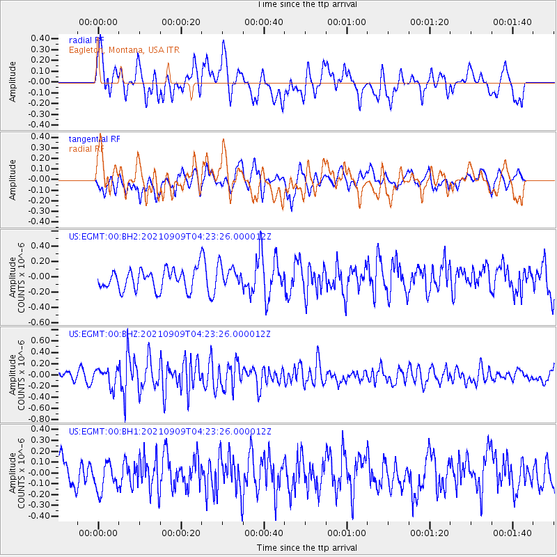
Signal To Noise
| Channel | StoN | STA | LTA |
| US:EGMT:00:BHZ:20210909T04:23:26.000012Z | 1.6243693 | 1.5905945E-7 | 9.7920754E-8 |
| US:EGMT:00:BH1:20210909T04:23:26.000012Z | 1.1159698 | 1.4892977E-7 | 1.3345324E-7 |
| US:EGMT:00:BH2:20210909T04:23:26.000012Z | 1.0923202 | 1.4344532E-7 | 1.3132167E-7 |
| Arrivals |
| Ps | |
| PpPs | |
| PsPs/PpSs | |


