You are here: Home > Network List > TA - USArray Transportable Network (new EarthScope stations) Stations List
> Station POKR Poker Plat Research Range, AK, USA > Earthquake Result Viewer
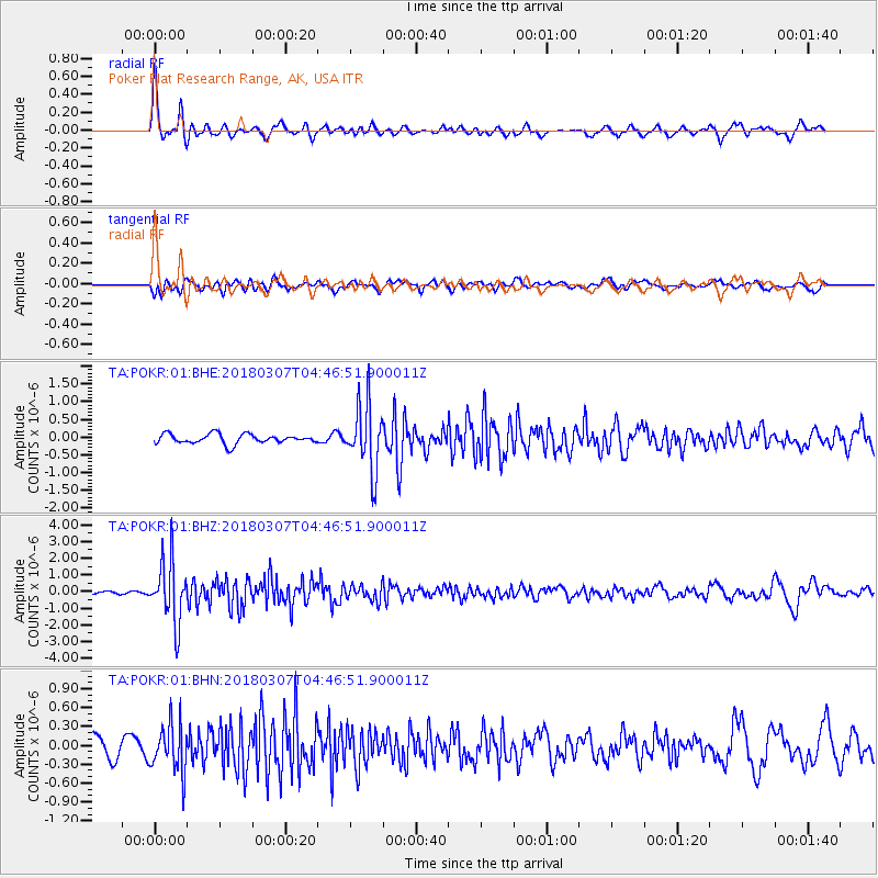
POKR Poker Plat Research Range, AK, USA - Earthquake Result Viewer
*The percent match for this event was below the threshold and hence no stack was calculated.
| Earthquake location: |
East Of Kuril Islands |
| Earthquake latitude/longitude: |
45.8/152.3 |
| Earthquake time(UTC): |
2018/03/07 (066) 04:40:12 GMT |
| Earthquake Depth: |
29 km |
| Earthquake Magnitude: |
5.8 Mww |
| Earthquake Catalog/Contributor: |
NEIC PDE/us |
|
| Network: |
TA USArray Transportable Network (new EarthScope stations) |
| Station: |
POKR Poker Plat Research Range, AK, USA |
| Lat/Lon: |
65.12 N/147.43 W |
| Elevation: |
501 m |
|
| Distance: |
37.4 deg |
| Az: |
37.225 deg |
| Baz: |
268.898 deg |
| Ray Param: |
$rayparam |
*The percent match for this event was below the threshold and hence was not used in the summary stack. |
|
| Radial Match: |
76.644394 % |
| Radial Bump: |
362 |
| Transverse Match: |
55.156395 % |
| Transverse Bump: |
400 |
| SOD ConfigId: |
2615551 |
| Insert Time: |
2018-03-21 04:43:59.309 +0000 |
| GWidth: |
2.5 |
| Max Bumps: |
400 |
| Tol: |
0.001 |
|
Signal To Noise
| Channel | StoN | STA | LTA |
| TA:POKR:01:BHZ:20180307T04:46:51.900011Z | 10.381761 | 1.8234539E-6 | 1.7564014E-7 |
| TA:POKR:01:BHN:20180307T04:46:51.900011Z | 2.4075904 | 3.9095804E-7 | 1.623856E-7 |
| TA:POKR:01:BHE:20180307T04:46:51.900011Z | 7.0234694 | 9.471954E-7 | 1.3486147E-7 |
| Arrivals |
| Ps | |
| PpPs | |
| PsPs/PpSs | |


