You are here: Home > Network List > CI - Caltech Regional Seismic Network Stations List
> Station SWS Sam W. Stewart, Westmorland, CA, USA > Earthquake Result Viewer
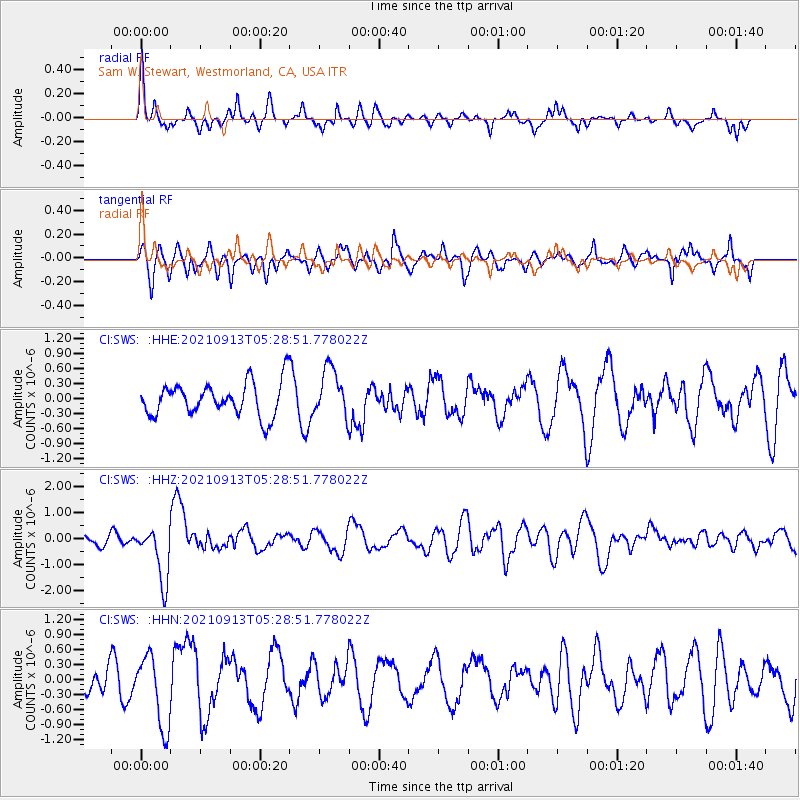
SWS Sam W. Stewart, Westmorland, CA, USA - Earthquake Result Viewer
*The percent match for this event was below the threshold and hence no stack was calculated.
| Earthquake location: |
Chile-Argentina Border Region |
| Earthquake latitude/longitude: |
-23.9/-67.0 |
| Earthquake time(UTC): |
2021/09/13 (256) 05:18:13 GMT |
| Earthquake Depth: |
193 km |
| Earthquake Magnitude: |
6.2 mww |
| Earthquake Catalog/Contributor: |
NEIC PDE/us |
|
| Network: |
CI Caltech Regional Seismic Network |
| Station: |
SWS Sam W. Stewart, Westmorland, CA, USA |
| Lat/Lon: |
32.94 N/115.80 W |
| Elevation: |
140 m |
|
| Distance: |
73.2 deg |
| Az: |
318.642 deg |
| Baz: |
134.007 deg |
| Ray Param: |
$rayparam |
*The percent match for this event was below the threshold and hence was not used in the summary stack. |
|
| Radial Match: |
65.60443 % |
| Radial Bump: |
330 |
| Transverse Match: |
56.73691 % |
| Transverse Bump: |
384 |
| SOD ConfigId: |
25131211 |
| Insert Time: |
2021-09-27 05:23:37.848 +0000 |
| GWidth: |
2.5 |
| Max Bumps: |
400 |
| Tol: |
0.001 |
|
Signal To Noise
| Channel | StoN | STA | LTA |
| CI:SWS: :HHZ:20210913T05:28:51.778022Z | 5.5039577 | 1.0653482E-6 | 1.9356038E-7 |
| CI:SWS: :HHN:20210913T05:28:51.778022Z | 2.427213 | 7.3054775E-7 | 3.0098212E-7 |
| CI:SWS: :HHE:20210913T05:28:51.778022Z | 1.4497231 | 4.844027E-7 | 3.341346E-7 |
| Arrivals |
| Ps | |
| PpPs | |
| PsPs/PpSs | |


