You are here: Home > Network List > IW - Intermountain West Stations List
> Station MOOW Moose Ponds, Wyoming, USA > Earthquake Result Viewer
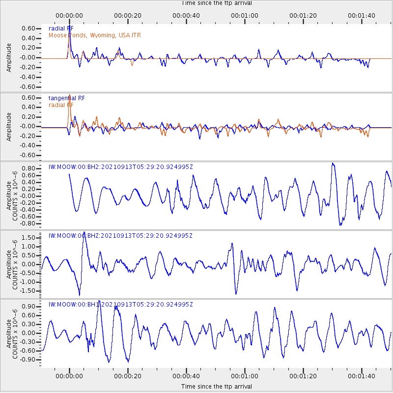
MOOW Moose Ponds, Wyoming, USA - Earthquake Result Viewer
*The percent match for this event was below the threshold and hence no stack was calculated.
| Earthquake location: |
Chile-Argentina Border Region |
| Earthquake latitude/longitude: |
-23.9/-67.0 |
| Earthquake time(UTC): |
2021/09/13 (256) 05:18:13 GMT |
| Earthquake Depth: |
193 km |
| Earthquake Magnitude: |
6.2 mww |
| Earthquake Catalog/Contributor: |
NEIC PDE/us |
|
| Network: |
IW Intermountain West |
| Station: |
MOOW Moose Ponds, Wyoming, USA |
| Lat/Lon: |
43.75 N/110.74 W |
| Elevation: |
2128 m |
|
| Distance: |
78.4 deg |
| Az: |
329.238 deg |
| Baz: |
139.757 deg |
| Ray Param: |
$rayparam |
*The percent match for this event was below the threshold and hence was not used in the summary stack. |
|
| Radial Match: |
59.188522 % |
| Radial Bump: |
311 |
| Transverse Match: |
39.27851 % |
| Transverse Bump: |
361 |
| SOD ConfigId: |
25131211 |
| Insert Time: |
2021-09-27 05:28:24.801 +0000 |
| GWidth: |
2.5 |
| Max Bumps: |
400 |
| Tol: |
0.001 |
|
Signal To Noise
| Channel | StoN | STA | LTA |
| IW:MOOW:00:BHZ:20210913T05:29:20.924995Z | 2.5520573 | 8.3383634E-7 | 3.2673105E-7 |
| IW:MOOW:00:BH1:20210913T05:29:20.924995Z | 0.7499946 | 2.0359958E-7 | 2.7146808E-7 |
| IW:MOOW:00:BH2:20210913T05:29:20.924995Z | 0.8543 | 2.2210295E-7 | 2.599824E-7 |
| Arrivals |
| Ps | |
| PpPs | |
| PsPs/PpSs | |


