You are here: Home > Network List > US - United States National Seismic Network Stations List
> Station DUG Dugway, Tooele County, Utah, USA > Earthquake Result Viewer
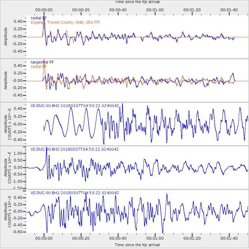
DUG Dugway, Tooele County, Utah, USA - Earthquake Result Viewer
*The percent match for this event was below the threshold and hence no stack was calculated.
| Earthquake location: |
East Of Kuril Islands |
| Earthquake latitude/longitude: |
45.8/152.3 |
| Earthquake time(UTC): |
2018/03/07 (066) 04:40:12 GMT |
| Earthquake Depth: |
29 km |
| Earthquake Magnitude: |
5.8 Mww |
| Earthquake Catalog/Contributor: |
NEIC PDE/us |
|
| Network: |
US United States National Seismic Network |
| Station: |
DUG Dugway, Tooele County, Utah, USA |
| Lat/Lon: |
40.19 N/112.81 W |
| Elevation: |
1477 m |
|
| Distance: |
65.6 deg |
| Az: |
56.966 deg |
| Baz: |
310.065 deg |
| Ray Param: |
$rayparam |
*The percent match for this event was below the threshold and hence was not used in the summary stack. |
|
| Radial Match: |
61.80255 % |
| Radial Bump: |
400 |
| Transverse Match: |
68.22903 % |
| Transverse Bump: |
400 |
| SOD ConfigId: |
2615551 |
| Insert Time: |
2018-03-21 04:45:14.440 +0000 |
| GWidth: |
2.5 |
| Max Bumps: |
400 |
| Tol: |
0.001 |
|
Signal To Noise
| Channel | StoN | STA | LTA |
| US:DUG:00:BHZ:20180307T04:50:22.024004Z | 4.0111256 | 5.6028705E-7 | 1.3968325E-7 |
| US:DUG:00:BH1:20180307T04:50:22.024004Z | 2.124003 | 2.276232E-7 | 1.0716708E-7 |
| US:DUG:00:BH2:20180307T04:50:22.024004Z | 1.300231 | 2.627073E-7 | 2.0204664E-7 |
| Arrivals |
| Ps | |
| PpPs | |
| PsPs/PpSs | |


