You are here: Home > Network List > US - United States National Seismic Network Stations List
> Station LAO LASA Array, Montana, USA > Earthquake Result Viewer
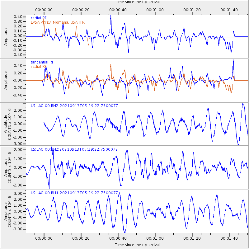
LAO LASA Array, Montana, USA - Earthquake Result Viewer
*The percent match for this event was below the threshold and hence no stack was calculated.
| Earthquake location: |
Chile-Argentina Border Region |
| Earthquake latitude/longitude: |
-23.9/-67.0 |
| Earthquake time(UTC): |
2021/09/13 (256) 05:18:13 GMT |
| Earthquake Depth: |
193 km |
| Earthquake Magnitude: |
6.2 mww |
| Earthquake Catalog/Contributor: |
NEIC PDE/us |
|
| Network: |
US United States National Seismic Network |
| Station: |
LAO LASA Array, Montana, USA |
| Lat/Lon: |
46.69 N/106.22 W |
| Elevation: |
902 m |
|
| Distance: |
78.7 deg |
| Az: |
333.654 deg |
| Baz: |
143.837 deg |
| Ray Param: |
$rayparam |
*The percent match for this event was below the threshold and hence was not used in the summary stack. |
|
| Radial Match: |
48.575264 % |
| Radial Bump: |
321 |
| Transverse Match: |
55.292442 % |
| Transverse Bump: |
324 |
| SOD ConfigId: |
25131211 |
| Insert Time: |
2021-09-27 05:40:14.005 +0000 |
| GWidth: |
2.5 |
| Max Bumps: |
400 |
| Tol: |
0.001 |
|
Signal To Noise
| Channel | StoN | STA | LTA |
| US:LAO:00:BHZ:20210913T05:29:22.750007Z | 1.705554 | 1.2349925E-6 | 7.2410046E-7 |
| US:LAO:00:BH1:20210913T05:29:22.750007Z | 1.0598549 | 9.663429E-7 | 9.1176906E-7 |
| US:LAO:00:BH2:20210913T05:29:22.750007Z | 0.5758317 | 4.873097E-7 | 8.4627095E-7 |
| Arrivals |
| Ps | |
| PpPs | |
| PsPs/PpSs | |


