You are here: Home > Network List > UU - University of Utah Regional Network Stations List
> Station FORU South Mineral Mountains, UT, USA > Earthquake Result Viewer
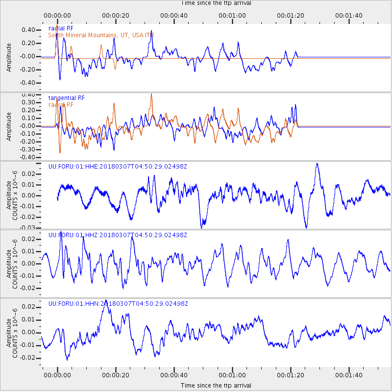
FORU South Mineral Mountains, UT, USA - Earthquake Result Viewer
*The percent match for this event was below the threshold and hence no stack was calculated.
| Earthquake location: |
East Of Kuril Islands |
| Earthquake latitude/longitude: |
45.8/152.3 |
| Earthquake time(UTC): |
2018/03/07 (066) 04:40:12 GMT |
| Earthquake Depth: |
29 km |
| Earthquake Magnitude: |
5.8 Mww |
| Earthquake Catalog/Contributor: |
NEIC PDE/us |
|
| Network: |
UU University of Utah Regional Network |
| Station: |
FORU South Mineral Mountains, UT, USA |
| Lat/Lon: |
38.46 N/112.86 W |
| Elevation: |
1840 m |
|
| Distance: |
66.6 deg |
| Az: |
58.438 deg |
| Baz: |
310.631 deg |
| Ray Param: |
$rayparam |
*The percent match for this event was below the threshold and hence was not used in the summary stack. |
|
| Radial Match: |
40.483974 % |
| Radial Bump: |
400 |
| Transverse Match: |
57.99914 % |
| Transverse Bump: |
383 |
| SOD ConfigId: |
2615551 |
| Insert Time: |
2018-03-21 04:46:12.707 +0000 |
| GWidth: |
2.5 |
| Max Bumps: |
400 |
| Tol: |
0.001 |
|
Signal To Noise
| Channel | StoN | STA | LTA |
| UU:FORU:01:HHZ:20180307T04:50:29.02498Z | 3.0956721 | 1.1066265E-8 | 3.5747536E-9 |
| UU:FORU:01:HHN:20180307T04:50:29.02498Z | 2.0234482 | 1.1886217E-8 | 5.874239E-9 |
| UU:FORU:01:HHE:20180307T04:50:29.02498Z | 1.3477774 | 9.7011394E-9 | 7.1978796E-9 |
| Arrivals |
| Ps | |
| PpPs | |
| PsPs/PpSs | |


