You are here: Home > Network List > UW - Pacific Northwest Regional Seismic Network Stations List
> Station HOOD Mt Hood Meadows, OR CREST BB SMO > Earthquake Result Viewer
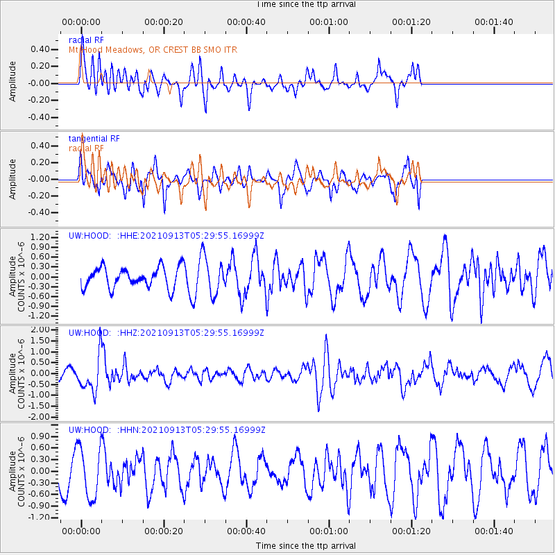
HOOD Mt Hood Meadows, OR CREST BB SMO - Earthquake Result Viewer
*The percent match for this event was below the threshold and hence no stack was calculated.
| Earthquake location: |
Chile-Argentina Border Region |
| Earthquake latitude/longitude: |
-23.9/-67.0 |
| Earthquake time(UTC): |
2021/09/13 (256) 05:18:13 GMT |
| Earthquake Depth: |
193 km |
| Earthquake Magnitude: |
6.2 mww |
| Earthquake Catalog/Contributor: |
NEIC PDE/us |
|
| Network: |
UW Pacific Northwest Regional Seismic Network |
| Station: |
HOOD Mt Hood Meadows, OR CREST BB SMO |
| Lat/Lon: |
45.32 N/121.65 W |
| Elevation: |
1520 m |
|
| Distance: |
84.9 deg |
| Az: |
324.717 deg |
| Baz: |
131.461 deg |
| Ray Param: |
$rayparam |
*The percent match for this event was below the threshold and hence was not used in the summary stack. |
|
| Radial Match: |
50.440514 % |
| Radial Bump: |
400 |
| Transverse Match: |
72.49165 % |
| Transverse Bump: |
400 |
| SOD ConfigId: |
25131211 |
| Insert Time: |
2021-09-27 05:41:53.517 +0000 |
| GWidth: |
2.5 |
| Max Bumps: |
400 |
| Tol: |
0.001 |
|
Signal To Noise
| Channel | StoN | STA | LTA |
| UW:HOOD: :HHZ:20210913T05:29:55.16999Z | 4.0255256 | 8.157233E-7 | 2.0263771E-7 |
| UW:HOOD: :HHN:20210913T05:29:55.16999Z | 2.0051987 | 6.6033476E-7 | 3.293114E-7 |
| UW:HOOD: :HHE:20210913T05:29:55.16999Z | 1.9077151 | 5.884662E-7 | 3.084665E-7 |
| Arrivals |
| Ps | |
| PpPs | |
| PsPs/PpSs | |


