You are here: Home > Network List > UU - University of Utah Regional Network Stations List
> Station KNB Kanab, UT, USA > Earthquake Result Viewer
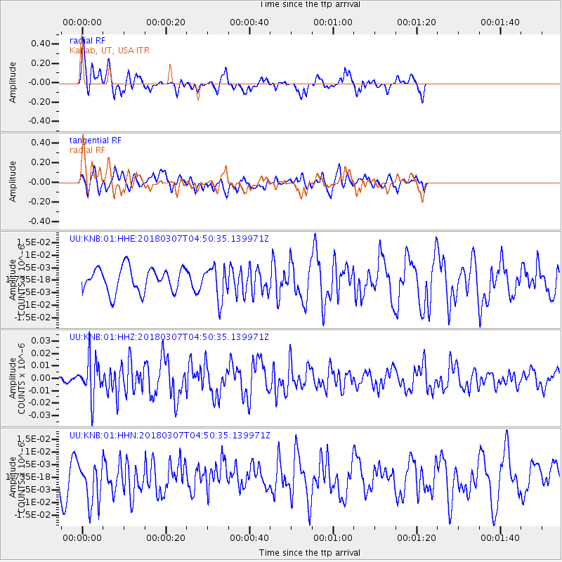
KNB Kanab, UT, USA - Earthquake Result Viewer
*The percent match for this event was below the threshold and hence no stack was calculated.
| Earthquake location: |
East Of Kuril Islands |
| Earthquake latitude/longitude: |
45.8/152.3 |
| Earthquake time(UTC): |
2018/03/07 (066) 04:40:12 GMT |
| Earthquake Depth: |
29 km |
| Earthquake Magnitude: |
5.8 Mww |
| Earthquake Catalog/Contributor: |
NEIC PDE/us |
|
| Network: |
UU University of Utah Regional Network |
| Station: |
KNB Kanab, UT, USA |
| Lat/Lon: |
37.02 N/112.82 W |
| Elevation: |
1715 m |
|
| Distance: |
67.6 deg |
| Az: |
59.597 deg |
| Baz: |
311.106 deg |
| Ray Param: |
$rayparam |
*The percent match for this event was below the threshold and hence was not used in the summary stack. |
|
| Radial Match: |
76.64549 % |
| Radial Bump: |
400 |
| Transverse Match: |
64.04026 % |
| Transverse Bump: |
400 |
| SOD ConfigId: |
2615551 |
| Insert Time: |
2018-03-21 04:46:17.466 +0000 |
| GWidth: |
2.5 |
| Max Bumps: |
400 |
| Tol: |
0.001 |
|
Signal To Noise
| Channel | StoN | STA | LTA |
| UU:KNB:01:HHZ:20180307T04:50:35.139971Z | 2.4997659 | 1.5550565E-8 | 6.2208088E-9 |
| UU:KNB:01:HHN:20180307T04:50:35.139971Z | 1.8291084 | 8.260961E-9 | 4.516387E-9 |
| UU:KNB:01:HHE:20180307T04:50:35.139971Z | 1.380959 | 6.592219E-9 | 4.773653E-9 |
| Arrivals |
| Ps | |
| PpPs | |
| PsPs/PpSs | |


